
Bănești, village in Telenești District, Moldova
Location: Telenești District
Elevation above the sea: 59 m
GPS coordinates: 47.56889,28.38083
Latest update: November 23, 2025 05:19

Body of water on Ciuluc river
7.7 km
Biserica „Sf. Nicolae”
3 km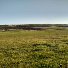
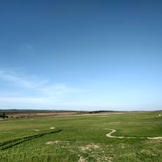
Puccinellia gigantea field
4.6 km
Bustul lui Mihai Eminescu
7.6 km
Monument în memoria a 54 consăteni căzuți în 1941-1945
3.4 km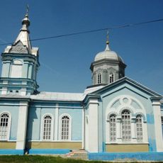
Saint Michael church in Inești, Telenești
7.6 km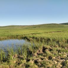
Halophyte meadow near Bănești
1.1 km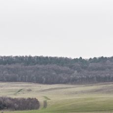
Poa pratensis field
7.4 km
Monument la mormântul comun al ostașilor căzuți (726) în 1944
7.7 km
Biserica „Sf. Gheorghe”
7.6 km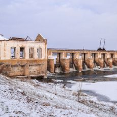
Hydroelectric power plant in Căzănești
8.2 km
Biserica „Sf. Ilie”
7.7 km
Tumuli - 14 - Verejeni
4.3 km
Tumuli - 7 - Vadul-Leca
7.7 km
Așezare - Mihailovca - I
7 km
Луг з пуччінелією розставленою
7.4 km
Așezare - Prepelița - X
2.3 km
Așezare - Prepelița - VIII
2.1 km
Tumuli - 3 - Inești
5 km
Tumuli - 8 - Prepelița
1.9 km
Așezare - Prepelița - I
5.6 km
Așezare - Telenești
6.5 km
Tumuli - 6 - Telenești
4.4 km
Așezare - Mihailovca - VII
8.3 km
Așezare - Prepelița - III
3 km
Tumul - Băneștii Noi
5.1 km
Tumuli - 6 - Chițcani
8.1 km
Cimitir vechi evreesc
7.4 kmReviews
Visited this place? Tap the stars to rate it and share your experience / photos with the community! Try now! You can cancel it anytime.
Discover hidden gems everywhere you go!
From secret cafés to breathtaking viewpoints, skip the crowded tourist spots and find places that match your style. Our app makes it easy with voice search, smart filtering, route optimization, and insider tips from travelers worldwide. Download now for the complete mobile experience.

A unique approach to discovering new places❞
— Le Figaro
All the places worth exploring❞
— France Info
A tailor-made excursion in just a few clicks❞
— 20 Minutes