Älvdalen 516:1, ristning, medeltid/historisk tid i Dalarna
Location: Älvdalen Municipality
GPS coordinates: 61.19906,14.19858
Latest update: November 2, 2025 00:43
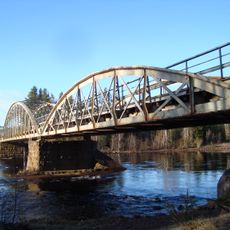
Oxbergsbron
7.5 km
Våmhus 46:2
2.8 km
Älvdalen 683
835 m
Älvdalen 516:4
70 m
Älvdalen 775
820 m
Älvdalen 667
872 m
Älvdalen 513:1
252 m
Älvdalen 771
930 m
Älvdalen 513:3
232 m
Älvdalen 514:1
242 m
Älvdalen 664
1.1 km
Älvdalen 643
847 m
Älvdalen 516:5
81 m
Älvdalen 516:3
27 m
Våmhus 46:4
2.8 km
Älvdalen 774
859 m
Älvdalen 681
805 m
Älvdalen 513:4
212 m
Älvdalen 645
865 m
Älvdalen 516:2
26 m
Älvdalen 515:1
89 m
Våmhus 46:3
2.8 km
Älvdalen 513:2
218 m
Älvdalen 773
828 m
Älvdalen 312:1
4.8 km
Våmhus 46:5
2.8 km
Scenic viewpoint
4.4 km
Scenic viewpoint
4.6 kmReviews
Visited this place? Tap the stars to rate it and share your experience / photos with the community! Try now! You can cancel it anytime.
Discover hidden gems everywhere you go!
From secret cafés to breathtaking viewpoints, skip the crowded tourist spots and find places that match your style. Our app makes it easy with voice search, smart filtering, route optimization, and insider tips from travelers worldwide. Download now for the complete mobile experience.

A unique approach to discovering new places❞
— Le Figaro
All the places worth exploring❞
— France Info
A tailor-made excursion in just a few clicks❞
— 20 Minutes