Kilanda 10:2, stone setting in Ale Municipality, Älvsborg County, Sweden
Location: Ale Municipality
GPS coordinates: 57.92269,12.26944
Latest update: November 21, 2025 14:18
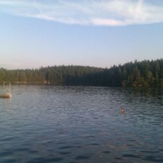
Hultasjön, Ale Municipality
2.1 km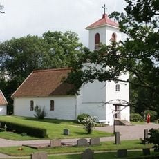
Kilanda Church
3.4 km
Anfastebo naturreservat
4 km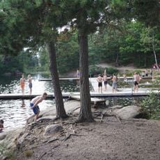
Hultasjön, public beach
2.2 km
Starrkärr 63:1
4.3 km
Östad 48:3
4 km
Kilanda 20:1
3.2 km
Starrkärr 64:1
4.3 km
Kilanda 2:1
3.2 km
Kilanda 4:1
2.7 km
Kilanda 6:1
198 m
Kilanda 10:1
35 m
Östad 162:1
4 km
Kilanda 19:1
3.5 km
Östad 161:1
3.4 km
Östad 71:1
4 km
Starrkärr 69:1
4.2 km
Östad 49:2
4 km
Östad 48:2
4 km
Starrkärr 63:2
4.3 km
Östad 51:1
4 km
Östad 48:1
4 km
Kilanda 78:1
3.5 km
Östad 49:1
4 km
Kilanda 26:1
3.2 km
Kilanda 19:3
3.5 km
Kilanda 19:2
3.5 km
Kilanda 15:1
3.5 kmReviews
Visited this place? Tap the stars to rate it and share your experience / photos with the community! Try now! You can cancel it anytime.
Discover hidden gems everywhere you go!
From secret cafés to breathtaking viewpoints, skip the crowded tourist spots and find places that match your style. Our app makes it easy with voice search, smart filtering, route optimization, and insider tips from travelers worldwide. Download now for the complete mobile experience.

A unique approach to discovering new places❞
— Le Figaro
All the places worth exploring❞
— France Info
A tailor-made excursion in just a few clicks❞
— 20 Minutes