Bolum 110:2, hällristning i Västergötland
Location: Falköping Municipality
GPS coordinates: 58.33642,13.60561
Latest update: October 26, 2025 18:55
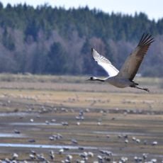
Lake Hornborga
3.8 km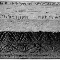
Västergötland Runic Inscription 81
3.7 km
Hornborgasjön
4.3 km
Bolum Heljesgården, Bolum
709 m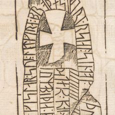
Västergötlands runinskrifter 76
3.4 km
Broddetorps ödekyrkogård
3.7 km
Bolum 92:2
863 m
Bolum 35:1
820 m
Bolum 16:4
2.2 km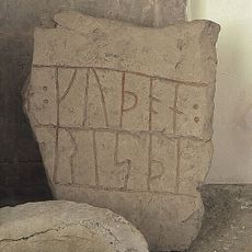
Västergötlands runinskrifter 82
4.2 km
Broddetorp 34:1
4.3 km
Bolum 167:1
1.9 km
Norra Lundby 38:3
4 km
Bolum 96:1
555 m
Kungagraven
4.7 km
Hornborga 55:1
4.2 km
Hornborga 60:2
4.2 km
Norra Lundby 77:2
1.8 km
Hornborga 90:2
4.7 km
"Storerör"
4.5 km
Kungagraven
4.7 km
Norra Lundby 103:2
4.6 km
Kungagraven
4.7 km
Hornborga 60:3
4.2 km
Bolum 100:1
422 m
Bolum 23:1
1.1 km
Bolum 19:1
1.8 km
Tower, Observation tower, scenic viewpoint
3.9 kmReviews
Visited this place? Tap the stars to rate it and share your experience / photos with the community! Try now! You can cancel it anytime.
Discover hidden gems everywhere you go!
From secret cafés to breathtaking viewpoints, skip the crowded tourist spots and find places that match your style. Our app makes it easy with voice search, smart filtering, route optimization, and insider tips from travelers worldwide. Download now for the complete mobile experience.

A unique approach to discovering new places❞
— Le Figaro
All the places worth exploring❞
— France Info
A tailor-made excursion in just a few clicks❞
— 20 Minutes