Rackeby 71:1, runristning i Västergötland
Location: Lidköping Municipality
GPS coordinates: 58.56654,13.01786
Latest update: November 24, 2025 04:11
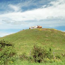
Colina de Skalunda
1.8 km
(Kung) Rackes sten
1 km
Rackeby 117:1
1.6 km
Skalunda 49
1.8 km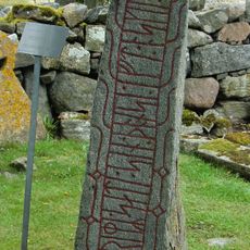
Västergötlands runinskrifter 37
1.2 km
Rackeby 39:2
1.1 km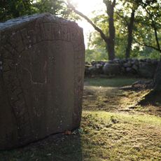
Vg 44
1.8 km
Rackeby 52:1
1.8 km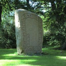
Vg 45 Skalunda kyrka
1.8 km
Skalunda hög
1.7 km
Rackeby 109:1
1.9 km
Skalunda 50
1.8 km
Rackeby 64:1
1.8 km
Skalunda 6:3
1.8 km
Rackeby 49:1
1.8 km
Rackeby 66:1
1.7 km
Rackeby 117:3
1.6 km
Rackeby 140:1
1.1 km
Onshögen
626 m
Rackeby 108:1
1.9 km
Rackeby 69:1
318 m
Rackeby 117:4
1.6 km
Rackeby 117:2
1.6 km
Rackeby 38:1
1.1 km
Rackeby 72:1
278 m
Rackeby 70:1
60 m
Rackeby 65:1
1.8 km
Rackeby 53:1
1.8 kmReviews
Visited this place? Tap the stars to rate it and share your experience / photos with the community! Try now! You can cancel it anytime.
Discover hidden gems everywhere you go!
From secret cafés to breathtaking viewpoints, skip the crowded tourist spots and find places that match your style. Our app makes it easy with voice search, smart filtering, route optimization, and insider tips from travelers worldwide. Download now for the complete mobile experience.

A unique approach to discovering new places❞
— Le Figaro
All the places worth exploring❞
— France Info
A tailor-made excursion in just a few clicks❞
— 20 Minutes