
Fåglaviks kapell
Location: Herrljunga Municipality
GPS coordinates: 58.11172,13.10630
Latest update: November 24, 2025 03:22
Ranahult
1.8 km
Skallstadens domänreservat
4.1 km
Hudene 249:1
4.2 km
Herrljunga 84:1
3.4 km
Herrljunga 50:2
3.7 km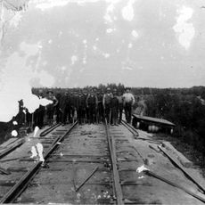
Fåglavik Embankment
843 m
Herrljunga 50:1
3.7 km
Österbitterna 41:1
4.4 km
Österbitterna 40:2
4.3 km
Larv 180:1
937 m
Herrljunga 83:1
3.3 km
Hudene 282:1
1.5 km
Hudene 122:1
4.3 km
Österbitterna 74:1
4.4 km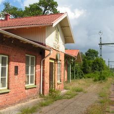
Fåglavik railway station
453 m
Herrljunga 53:1
3.9 km
Hudene 89:1
4.2 km
Herrljunga 60:1
4.3 km
Herrljunga 61:2
4.5 km
Österbitterna 40:3
4.3 km
Hudene 249:2
4.2 km
Herrljunga 87:1
3.2 km
Österbitterna 40:1
4.3 km
Hudene 160:1
3.6 km
Herrljunga 6:1
4.5 km
Herrljunga 57:1
3.9 km
Larv 71:1
4.1 km
Herrljunga 1:1
2.8 kmReviews
Visited this place? Tap the stars to rate it and share your experience / photos with the community! Try now! You can cancel it anytime.
Discover hidden gems everywhere you go!
From secret cafés to breathtaking viewpoints, skip the crowded tourist spots and find places that match your style. Our app makes it easy with voice search, smart filtering, route optimization, and insider tips from travelers worldwide. Download now for the complete mobile experience.

A unique approach to discovering new places❞
— Le Figaro
All the places worth exploring❞
— France Info
A tailor-made excursion in just a few clicks❞
— 20 Minutes