Ljusne Södra nedre, منارة في السويد
Location: Söderhamn Municipality
Inception: 1977
GPS coordinates: 61.20039,17.13164
Latest update: November 21, 2025 22:00

Vallviks kapell
2.9 km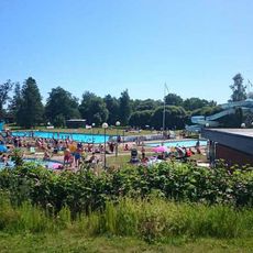
Ljusnebadet
1.1 km
Lillgrytans fyr
628 m
Vallvik lower light
2.4 km
Orrskär Östra
2.4 km
Söderala 141:1
2.1 km
Orrskär middle light
2.4 km
Storstensharet
1.2 km
Storgrytan lighthouse
1.5 km
Vallvik lighthouse
2.8 km
Orrskär upper light
2.4 km
Ljusne Trålhamn nedre
577 m
Vallvik upper light
2.7 km
Kajgrundet nedre
2.4 km
Ljusne Trålhamn övre
680 m
Orrskär Västra
2.3 km
Söderala 232:1
1.8 km
Söderala 216:1
3 km
Söderala 141:3
2.2 km
Ljusne Södra övre
66 m
Kajgrundet övre
2.6 km
Söderala 113:2
2.9 km
Söderala 104:1
2.3 km
Söderala 103:1
2.2 km
Söderala 141:2
2.2 km
Söderala 113:1
2.9 km
Söderala 105:1
2.3 km
Söderala 101:1
1.8 kmReviews
Visited this place? Tap the stars to rate it and share your experience / photos with the community! Try now! You can cancel it anytime.
Discover hidden gems everywhere you go!
From secret cafés to breathtaking viewpoints, skip the crowded tourist spots and find places that match your style. Our app makes it easy with voice search, smart filtering, route optimization, and insider tips from travelers worldwide. Download now for the complete mobile experience.

A unique approach to discovering new places❞
— Le Figaro
All the places worth exploring❞
— France Info
A tailor-made excursion in just a few clicks❞
— 20 Minutes