Hương Thọ, Landgemeinde in Vietnam
Location: Huế
Elevation above the sea: 8 m
GPS coordinates: 16.37389,107.89583
Latest update: November 17, 2025 08:47

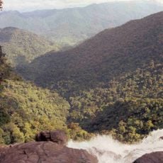
Bach Ma National Park
19.6 km
Tu Hien Bridge
3.3 km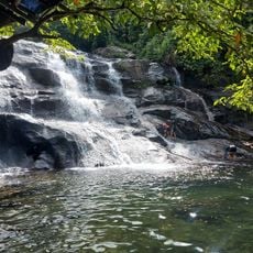
Thác Nhị Hồ
15.3 km
Khe Su 4 Quán Dì Hường
16.6 km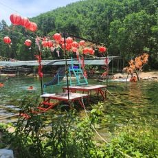
Nhà Nâu Trại Suối Khe Su 3
15.7 km
Work of art, sculpture
16.3 km
Work of art, sculpture
16.3 km
Đầm Cầu Hai
7.9 km
An Banh City of Ghosts
9.2 km
Motorbike stop
11.3 km
Fishing Village
12.7 km
Bach Ma National Park
18.2 km
Elephant Springs
17.7 km
Start of the Pheasant Trail
16.8 km
Elephant Waterfall Turn
14.7 km
Work of art, sculpture
16.3 km
Tam Giang Lagoon
2.1 km
Work of art, sculpture
16.3 km
Sculpture, Work of art
16.3 km
Work of art, sculpture
16.3 km
Work of art, sculpture
16.3 km
Sculpture, Work of art
16.3 km
Waterfall
16.9 km
Greatest Football Field #bor
11.5 km
Monument
16.2 km
Nhi Ho Waterfall
14.4 km
Nhi Ho Waterfall
15.3 km
Waterfall
16.9 kmReviews
Visited this place? Tap the stars to rate it and share your experience / photos with the community! Try now! You can cancel it anytime.
Discover hidden gems everywhere you go!
From secret cafés to breathtaking viewpoints, skip the crowded tourist spots and find places that match your style. Our app makes it easy with voice search, smart filtering, route optimization, and insider tips from travelers worldwide. Download now for the complete mobile experience.

A unique approach to discovering new places❞
— Le Figaro
All the places worth exploring❞
— France Info
A tailor-made excursion in just a few clicks❞
— 20 Minutes