
Barn To North East Of Packthorne Farmhouse, barn in Whitminster, Stroud, Gloucestershire, UK
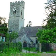
Whitminster Church
722 m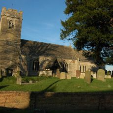
Church of St James
1.6 km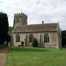
Church of St Stephen
1.4 km
Hathaway Monument, About 2M South Of West Tower In Churchyard Of Church Of St James
1.6 km
Pa- - - - - Monument, About 4M South West Of South Door In Churchyard Of Church Of St Stephen
1.4 km
Two Unidentified Monuments, Immediately West Of South Porch In Churchyard Of Church Of St James
1.6 km
Two Hawkins Monuments, About 11M South West Of East End Of Chancel In Churchyard Of Church Of St Andrew
716 m
Three Unidentified Monuments, In Line Immediately East Of North Porch In Churchyard Of Church Of St Stephen
1.4 km
Walk Farmhouse
1 km
Baldwin House And Baldwin Cottage
1.3 km
Lock And Lockgates Canal (North West Side Of Gloucester And Sharpness Canal, And Immedieatly West Of Bridge Over Same)
949 m
Whitminster House
767 m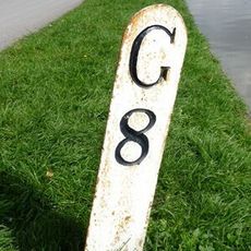
Milestone At National Grid Reference So 755 092
1.1 km
Packthorne Farmhouse
41 m
King's Orchard
1.3 km
Jaxons Farmhouse
1.4 km
Lea Court Farm
1.3 km
Unidentified Monument, About 6M South East Of South Door In Churchyard Of Church Of St Stephen
1.4 km
Moated site at Church Farm
1.4 km
Three King Monuments, About 11M South Of Porch In Churchyard Of Church Of Church Of St Andrew
731 m
Two Hewlett Monuments, About 1.5M East Of South Aisle In Churchyard Of Church Of St Stephen
1.5 km
Barracks Farmhouse
1.5 km
Woodfield House With Perimeter Wall To North And West, Gates And Railings Linking On South Side
1.5 km
Parkend Bridge House
1.6 km
Lock House
1.6 km
Brewer Monument, About 10M South Of Priest's Door In Churchyard Of Church Of St Andrew
720 m
Two Holder Monuments, About 6M South East Of South Porch In Churchyard Of Church Of St James
1.6 km
Milepost At National Grid Reference So 767 102
658 mReviews
Visited this place? Tap the stars to rate it and share your experience / photos with the community! Try now! You can cancel it anytime.
Discover hidden gems everywhere you go!
From secret cafés to breathtaking viewpoints, skip the crowded tourist spots and find places that match your style. Our app makes it easy with voice search, smart filtering, route optimization, and insider tips from travelers worldwide. Download now for the complete mobile experience.

A unique approach to discovering new places❞
— Le Figaro
All the places worth exploring❞
— France Info
A tailor-made excursion in just a few clicks❞
— 20 Minutes