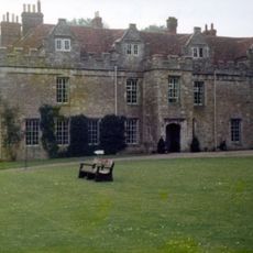
Wierton Grange, building in Boughton Monchelsea, Maidstone, Kent, UK
Location: Boughton Monchelsea
GPS coordinates: 51.22362,0.55349
Latest update: November 22, 2025 15:12
Boughton Monchelsea Place
1.3 km
3, Park Lane
936 m
Wierton Cottage
619 m
Wierton Hall Farm Cottage
345 m
Iden Farmhouse
692 m
Barn About 70 Metres West North West Of East Hall
650 m
Parsonage Farmhouse
1.1 km
Barn About 56 Metres West Of East Hall
682 m
Swallows
956 m
Tilts House
756 m
Wierton Hall
348 m
Garden Gateway About 20 Metres East Of East Hall
679 m
Old Amber Green Farmhouse
582 m
Mounting Block About 5 Metres South West Of Tilts House
753 m
Railings About 3 Metres South Of Tilts House
746 m
Tanyard
829 m
Lested Lodge
1.2 km
The Moorings
1.3 km
Marshalls Place
965 m
Heronden
1.2 km
The Cock Inn
980 m
Iden Farm
657 m
East Hall
677 m
House Attached To North Of Post Office Stores
1.2 km
Martins Farmhouse
956 m
Wierton Place
458 m
Garden Building To The North-West Of Wierton Place
485 m
Mounting Block in Front of East Elevation of Boughton Monchelsea House
1.3 kmReviews
Visited this place? Tap the stars to rate it and share your experience / photos with the community! Try now! You can cancel it anytime.
Discover hidden gems everywhere you go!
From secret cafés to breathtaking viewpoints, skip the crowded tourist spots and find places that match your style. Our app makes it easy with voice search, smart filtering, route optimization, and insider tips from travelers worldwide. Download now for the complete mobile experience.

A unique approach to discovering new places❞
— Le Figaro
All the places worth exploring❞
— France Info
A tailor-made excursion in just a few clicks❞
— 20 Minutes