122, Chapel Street, building in East Malling and Larkfield, Tonbridge and Malling, Kent, UK
Location: East Malling and Larkfield
GPS coordinates: 51.28128,0.43645
Latest update: November 23, 2025 11:42

Tamarisk Cottage
451 m
Holly Cottage Raven Cottage
466 m
24 And 26, High Street
641 m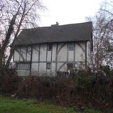
The Barracks
643 m
Kinross Cottage
473 m
The Forge House
604 m
Derbies
602 m
Paris Farmhouse
532 m
45, High Street
591 m
1-5, Mill Street
711 m
132, The Rocks Road
522 m
205, Well Street
574 m
Spring Head Farmhouse
633 m
Ivy House Farmhouse
322 m
Ingleside
706 m
Part of an Iron Age enclosure and a minor Roman villa 128m SSE of the Church of St James
650 m
10-16, High Street
677 m
Dovecot 30 Yards North East Of Paris Farmhouse
565 m
Rock Farmhouse
456 m
Wall To North East Of The Limes
419 m
6, The Rocks Road
515 m
Barn 80 Yards To The East Of Paris Farmhouse
566 m
The Limes
405 m
The Vicarage
656 m
Heath Cottage
531 m
185, Well Street
628 m
Spring Hill Lodge
586 m
257-259, Well Street
618 mReviews
Visited this place? Tap the stars to rate it and share your experience / photos with the community! Try now! You can cancel it anytime.
Discover hidden gems everywhere you go!
From secret cafés to breathtaking viewpoints, skip the crowded tourist spots and find places that match your style. Our app makes it easy with voice search, smart filtering, route optimization, and insider tips from travelers worldwide. Download now for the complete mobile experience.

A unique approach to discovering new places❞
— Le Figaro
All the places worth exploring❞
— France Info
A tailor-made excursion in just a few clicks❞
— 20 Minutes