Aymers, architectural structure in Lynsted with Kingsdown, Swale, Kent, UK
Location: Lynsted with Kingsdown
GPS coordinates: 51.31111,0.78874
Latest update: November 24, 2025 11:12
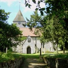
Church of St Peter and St Paul, Lynsted
360 m
Black Lion Public House
416 m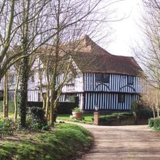
Lynsted Court
288 m
Bumpit
808 m
Anchor House
287 m
Berkeley House
575 m
Ludgate
906 m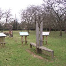
Park Farm Community Cherry Orchard
197 m
Lyndale
381 m
Hillside House
296 m
Forge House
268 m
Bogle
912 m
Lynsted Court Cottage
325 m
Tenacre Farmhouse
867 m
The Batteries
750 m
Heathfield
333 m
Barn, 15 Yards South Of Bogle
894 m
Mill 15 Yards East Of Berkeley House
568 m
Wall Opposite St Peter And St Paul's Church
342 m
Barn 20 Yards East Of Batteries
742 m
Vicarage Farmhouse
432 m
Oasthouse And Oasts 30 Yards South West Of Batteries
740 m
Oak Cottages
349 m
Champion's Windmill, 50 Yards North West Of Berkeley House
619 m
The Vicarage
476 m
The Post Office
272 m
King George Vi K6 Telephone Kiosk (Outside Post Office)
258 m
Barns 30 Yards West Of Lynsted Court
335 mReviews
Visited this place? Tap the stars to rate it and share your experience / photos with the community! Try now! You can cancel it anytime.
Discover hidden gems everywhere you go!
From secret cafés to breathtaking viewpoints, skip the crowded tourist spots and find places that match your style. Our app makes it easy with voice search, smart filtering, route optimization, and insider tips from travelers worldwide. Download now for the complete mobile experience.

A unique approach to discovering new places❞
— Le Figaro
All the places worth exploring❞
— France Info
A tailor-made excursion in just a few clicks❞
— 20 Minutes