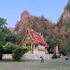
นำตกสาละนิน
Location: จังหวัดเพชรบูรณ์
GPS coordinates: 16.41042,100.87539
Latest update: November 2, 2025 10:37
Wat Ban Mung
25.9 km
Namtok Si Dit
25.4 km
Khao Kho Royal Palace
19.2 km
Cave. Bats
26.2 km
Khao Kho National Park Visitor Center
21 km
Bang Rachan Islet
15.9 km
Boat Cave
25.8 km
ครกพลังน้ำ
25.3 km
บ้านพักผกค.
25.3 km
Naresuan Cave
25.5 km
Tham Duan - Tham Dao
25.3 km
Turtle Cave
25.4 km
Monastery
23 km
Monument & Machine Gun Posts
25.7 km
Scenic viewpoint
24.8 km
Scenic viewpoint
24.3 km
Scenic viewpoint
24.4 km
Scenic viewpoint
24.4 km
Scenic viewpoint
25.7 km
Scenic viewpoint
25.7 km
Scenic viewpoint
19.1 km
Scenic viewpoint
18.5 km
Scenic viewpoint
25.8 km
Scenic viewpoint
20.4 km
Scenic viewpoint
20.3 km
ทุ่งนางพญาเมืองเลน
13.1 km
Kong Nium Temple Viewpoint
22.8 km
อนุสาวรีย์ผู้เสียสละ
25.6 kmReviews
Visited this place? Tap the stars to rate it and share your experience / photos with the community! Try now! You can cancel it anytime.
Discover hidden gems everywhere you go!
From secret cafés to breathtaking viewpoints, skip the crowded tourist spots and find places that match your style. Our app makes it easy with voice search, smart filtering, route optimization, and insider tips from travelers worldwide. Download now for the complete mobile experience.

A unique approach to discovering new places❞
— Le Figaro
All the places worth exploring❞
— France Info
A tailor-made excursion in just a few clicks❞
— 20 Minutes