California Redwoods
Location: Tararua District
GPS coordinates: -40.72388,175.63817
Latest update: November 21, 2025 00:48
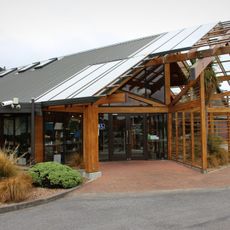
Pūkaha National Wildlife Centre
342 m
Ruapae Falls
10.8 km
Mauriceville North Church (Methodist)
4.5 km
North Anzac Bridge Unnamed Scenic Reserve
2.9 km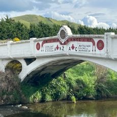
ANZAC Memorial Bridge
2.8 km
Schou's Barn
4.1 km
Wiwaka Station Woolshed
8.2 km
Pukaha / Mount Bruce Scenic Reserve
2.3 km
House (14 Bengston Street and Haswell Street)
10.5 km
Big Kiwi
10.3 km
Eketahuna School (Former)
10.5 km
Tuatara
287 m
Lookout
3 km
Eel Feeding
141 m
Kaka Circus
233 m
Octorarium
9.7 km
Giant White Kiwi
10.3 km
Takahe
292 m
Work of art
10.3 km
Lookout
701 m
Swingbridge 1890 Site
9.7 km
Scenic viewpoint
550 m
Memorial
5.5 km
Memorial
5.5 km
War Memorial
10.3 km
Volunteer Fire Brigade
10.3 km
Waterfall
9.6 km
Waterfall
9.7 kmReviews
Visited this place? Tap the stars to rate it and share your experience / photos with the community! Try now! You can cancel it anytime.
Discover hidden gems everywhere you go!
From secret cafés to breathtaking viewpoints, skip the crowded tourist spots and find places that match your style. Our app makes it easy with voice search, smart filtering, route optimization, and insider tips from travelers worldwide. Download now for the complete mobile experience.

A unique approach to discovering new places❞
— Le Figaro
All the places worth exploring❞
— France Info
A tailor-made excursion in just a few clicks❞
— 20 Minutes