OWŚ
Location: gmina Bobrowniki
GPS coordinates: 50.44295,19.02137
Latest update: November 23, 2025 22:32
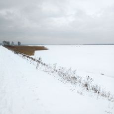
Kozłowa Góra Lake
3.5 km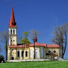
Saint Jacob Church in Sączów
975 m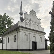
St. Barbara church in Ożarowice, Poland
2.6 km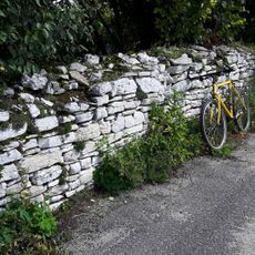
Folwark fence in Myszkowice
3 km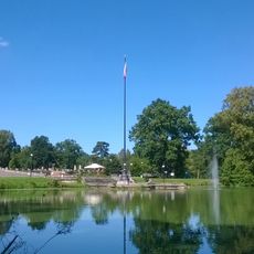
Flagpole in Świerklaniec
4.8 km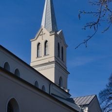
All Saints church in Siemonia
3.4 km
Kaplica w Nowej Wsi
4.7 km
OWŚ
3.7 km
OWŚ
3.6 km
Granica etnograficzna Małopolska - Górny Śląsk
2.9 km
OWŚ
959 m
OWŚ
1 km
OWŚ 5
3 km
OWŚ 4
2.7 km
Upper Silesian Mining History hiking trail
4.1 km
OWŚ
3.3 km
OWŚ
3.5 km
OWŚ
2.7 km
Granica etnograficzna Małopolska - Górny Śląsk
3.7 km
Plaża Rogoźnik II
4.7 km
Statue, Work of art
3.4 km
Statue, Work of art
3.4 km
Statue, Work of art
3.4 km
Scenic viewpoint
4.6 km
Platforma spotterska „08”
4.3 km
Punkt Widokowy Pyrzowice Ożarowice 4K – Lotnisko
3.6 km
Punkt widokowy na Zalew Świerklaniec
3.9 km
Waterfall
4.5 kmReviews
Visited this place? Tap the stars to rate it and share your experience / photos with the community! Try now! You can cancel it anytime.
Discover hidden gems everywhere you go!
From secret cafés to breathtaking viewpoints, skip the crowded tourist spots and find places that match your style. Our app makes it easy with voice search, smart filtering, route optimization, and insider tips from travelers worldwide. Download now for the complete mobile experience.

A unique approach to discovering new places❞
— Le Figaro
All the places worth exploring❞
— France Info
A tailor-made excursion in just a few clicks❞
— 20 Minutes