Playa Costa del Sol
Location: Municipio de San Luis La Herradura
GPS coordinates: 13.34385,-89.00719
Latest update: November 23, 2025 20:45
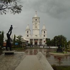
Catedral de Zacatecoluca
23.7 km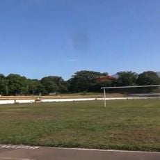
Estadio Antonio Toledo Valle
24.5 km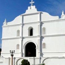
Saint Sebastian Analco Church
23.4 km
Playa Costa del Sol
91 m
Playa La Zunganera
15 km
Playa San Marcelino
2 km
Playa Las Bocanitas
18.9 km
Playa Los Blancos
2.8 km
Playa El Pimiental
6.3 km
Playa Toluca
25.4 km
Playa Amatecampo
16.9 km
Playa Las Hojas
4.3 km
Las Bocanitas
18 km
Playa Los Negros
21.5 km
Tasajera
15.6 km
Fuente - San Sebastian
23.4 km
Kiosko La Alameda
23.4 km
Beach
18.3 km
Villa Tapalhuaca
25.4 km
Parque La Alameda
23.4 km
Playa Las Hojas
4.4 km
El Pimental
7 km
Playa Costa del Sol
1.4 km
Playa Los Blancos
6.1 km
Playa San Marcelino
2.3 km
Playa zunganera
14.8 km
Playa La Puntilla
11 km
Playa Los Negros
20.1 kmReviews
Visited this place? Tap the stars to rate it and share your experience / photos with the community! Try now! You can cancel it anytime.
Discover hidden gems everywhere you go!
From secret cafés to breathtaking viewpoints, skip the crowded tourist spots and find places that match your style. Our app makes it easy with voice search, smart filtering, route optimization, and insider tips from travelers worldwide. Download now for the complete mobile experience.

A unique approach to discovering new places❞
— Le Figaro
All the places worth exploring❞
— France Info
A tailor-made excursion in just a few clicks❞
— 20 Minutes