Marienstein
Location: Treuen
Made from material: wood
GPS coordinates: 50.51750,12.33966
Latest update: November 22, 2025 20:35

Rittergut Adlershof
2.9 km
Knock
1.9 km
Schule Schulgasse 2
1.8 km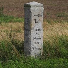
Wegesäule in Unterlauterbach
2.6 km
Ehemalige Schule Hauptstraße 59
2.2 km
Pfarrhaus Schillerstraße 10
2.3 km
Wohnhaus Alte Treuener Straße 14
1.3 km
Kriegerdenkmal Hauptstraße 59 (gegenüber)
2.2 km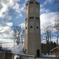
Water tower Rebesgrüner Höhe
2.8 km
Wohnhaus und Einfriedung Auerbacher Straße 32
1.1 km
Sachgesamtheit Rittergut Unterlauterbach Treuener Straße 2; 4; 6; 8; 10; 10a
2.9 km
Einzeldenkmale der Sachgesamtheit Rittergut Unterlauterbach Treuener Straße 2; 4; 6; 8; 10; 10a
2.9 km
Wohnstallhaus Altmannsgrüner Straße 75; 77
2.9 km
Friedhofskapelle Friedensstraße
1.7 km
Wohnhaus mit Einfriedung und Stützmauer Friedensring 24
1.1 km
Schulbau und Einfriedung Auerbacher Straße 10
1.1 km
Wohnstallhaus Reumtengrüner Hauptstraße 72
1.6 km
Herrenhaus des ehemaligen Rittergutes Treuen oberen Teils Schloßweg 1a
2.9 km
Kriegerdenkmal Reumtengrüner Hauptstraße 48 (gegenüber)
1.6 km
Wohnstallhaus Reumtengrüner Hauptstraße 60
1.7 km
Gasthaus Friedensring 3
1 km
Kriegerdenkmal und Wassertrog Gartenstraße
1 km
Drei Pechpfannen Schulgasse 4 (gegenüber)
1.7 km
Wohnhaus Auerbacher Straße 17
2.4 km
Freibad Treuen
2.5 km
Wasserrutsche
2.5 km
Dreieinigkeit
1.1 km
Scenic viewpoint
1.6 kmReviews
Visited this place? Tap the stars to rate it and share your experience / photos with the community! Try now! You can cancel it anytime.
Discover hidden gems everywhere you go!
From secret cafés to breathtaking viewpoints, skip the crowded tourist spots and find places that match your style. Our app makes it easy with voice search, smart filtering, route optimization, and insider tips from travelers worldwide. Download now for the complete mobile experience.

A unique approach to discovering new places❞
— Le Figaro
All the places worth exploring❞
— France Info
A tailor-made excursion in just a few clicks❞
— 20 Minutes