
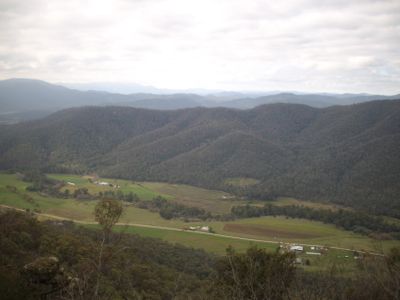
King Valley, locality in Victoria, Australia
Location: Rural City of Wangaratta
GPS coordinates: -36.69479,146.40828
Latest update: November 17, 2025 08:19
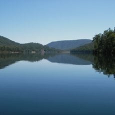
Lake William Hovell
25.2 km
McCallsay Reservoir
20.4 km
Kelly Gang Camp Site
27.1 km
Lookout
20.1 km
Approx. site of Hume and Hovell camp 25 Nov 1824
13.3 km
Historic Marker
6.2 km
Brookfield Maze
11 km
Power's Lookout
17.2 km
Powers waterhole
17.2 km
Tatong CFA mural
27.2 km
Paradise Falls view
19.4 km
Scenic viewpoint
8.6 km
Powers Lookout 2
17.1 km
Powers Lookout
17 km
Gracebrook Winery
3.1 km
Approx. site of Hume and Hovell camp 26 Nov 1824
10.9 km
Brookfield Maze - garden, cafe, accomodation
11.5 km
Approx. site of Hume and Hovell camp 27 Nov 1824
26.1 km
Monument
13.2 km
Shed
1 km
War Memorial Gate
26.3 km
Hume & Hovell Monument
26.3 km
Memorial
11.4 km
Stringybark Creek
27.3 km
Kelly Hut / Old Mill
27.1 km
Hume and Hovell
13.2 km
Paradise Falls
19.5 km
Little Falls
19.7 kmReviews
Visited this place? Tap the stars to rate it and share your experience / photos with the community! Try now! You can cancel it anytime.
Discover hidden gems everywhere you go!
From secret cafés to breathtaking viewpoints, skip the crowded tourist spots and find places that match your style. Our app makes it easy with voice search, smart filtering, route optimization, and insider tips from travelers worldwide. Download now for the complete mobile experience.

A unique approach to discovering new places❞
— Le Figaro
All the places worth exploring❞
— France Info
A tailor-made excursion in just a few clicks❞
— 20 Minutes