
Bildstock, bildstock, gemauert, mit Zeltdach, 18. Jahrhundert; an der Robert- Bosch-Straße
Location: Traunreut
Address: Nähe Robert-Bosch-Straße
GPS coordinates: 47.94227,12.59832
Latest update: November 19, 2025 05:53

Schloss Pertenstein
394 m
Mariä Geburt (Traunwalchen)
430 m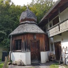
Frauenbrunn-Kapelle
312 m
Friedhof bei der Pfarrkirche
430 m
Privatkapelle
336 m
Weilerkapelle
456 m
Friedhof Pfarrhofstraße 1 in Traunreut
448 m
Friedhof Pfarrhofstraße 3 in Traunreut
452 m
Cultural heritage D-1-8041-0094 in Traunreut
398 m
Ehem. Bauernhaus
737 m
Friedhof Nähe Raiffeisenstraße in Traunreut
431 m
Steinbruch in Traunwalchen/Talmühle
629 m
Leichenhalle Pfarrhofstraße 1 in Traunreut
456 m
Kapellenneubau
420 m
Cultural heritage D-1-8041-0249 in Traunreut
397 m
Kriegerdenkmal Pfarrhofstraße 1 in Traunreut
447 m
Schloss Schloßstraße 6 in Traunreut
352 m
Stall Schloßstraße 4 in Traunreut
396 m
Gasthof
412 m
Cultural heritage D-1-8041-0230 in Traunreut
444 m
Kleinhaus
313 m
Pfarrhaus
418 m
Cultural heritage D-1-8041-0256 in Traunreut
312 m
Zugehörig Stadel mit Bundwerkfront
679 m
"Walzmühle"
344 m
Bildstock
318 m
Remise Schloßstraße 4 in Traunreut
375 m
Wayside shrine, Christianity
318 mReviews
Visited this place? Tap the stars to rate it and share your experience / photos with the community! Try now! You can cancel it anytime.
Discover hidden gems everywhere you go!
From secret cafés to breathtaking viewpoints, skip the crowded tourist spots and find places that match your style. Our app makes it easy with voice search, smart filtering, route optimization, and insider tips from travelers worldwide. Download now for the complete mobile experience.

A unique approach to discovering new places❞
— Le Figaro
All the places worth exploring❞
— France Info
A tailor-made excursion in just a few clicks❞
— 20 Minutes