
Zugehöriger Stadel, satteldachbau mit Bundwerk, 1. Hälfte 19. Jh., mit drei eingebauten Getreidekästen, einer davon datiert 1778, nach Südwesten modern verlängert
Location: Eiselfing
Address: Höhfelden 2
GPS coordinates: 48.04128,12.21181
Latest update: November 24, 2023 20:01
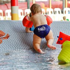
Badria
1.6 km
St. Laurentius
878 m
Wegmachermuseum Wasserburg
656 m
Cultural heritage D-1-7939-0076 in Wasserburg am Inn
1.7 km
Cultural heritage D-1-7939-0219 in Eiselfing
876 m
Cultural heritage D-1-7939-0072 in Eiselfing
1 km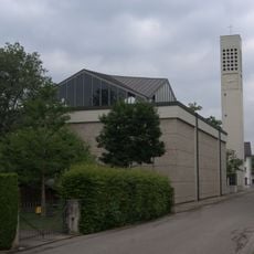
Katholische Stadtpfarrkirche St. Konrad
1.6 km
Krankenhaus Gabersee 34 in Wasserburg am Inn
1.9 km
Bassin Gabersee 33 in Wasserburg am Inn
1.8 km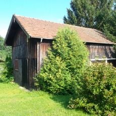
Blockbau-Obergeschoss eines ehemaligen Einfirsthofes
1.8 km
Bildstock
980 m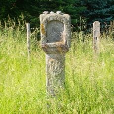
Bildstock
1.9 km
Cultural heritage D-1-7939-0086 in Wasserburg am Inn
1.3 km
Sculpture, Work of art
1.2 km
St. Konrad
1.6 km
Wayside cross, Christianity
1.2 km
Wayside cross
1.5 km
Catholic church building, wayside cross, Christianity
1.6 km
Wayside cross, Christianity
1.1 km
Bachsause
1.6 km
Wayside cross, Christianity
1.3 km
Innbrücken Eisbrecher
1.1 km
Familienbreitrutsche
1.6 km
Memorial, stele
981 m
TSV Gedenkstein
1.7 km
Scenic viewpoint
959 m
Wayside cross
953 m
Sebastian Blödl
929 mReviews
Visited this place? Tap the stars to rate it and share your experience / photos with the community! Try now! You can cancel it anytime.
Discover hidden gems everywhere you go!
From secret cafés to breathtaking viewpoints, skip the crowded tourist spots and find places that match your style. Our app makes it easy with voice search, smart filtering, route optimization, and insider tips from travelers worldwide. Download now for the complete mobile experience.

A unique approach to discovering new places❞
— Le Figaro
All the places worth exploring❞
— France Info
A tailor-made excursion in just a few clicks❞
— 20 Minutes