
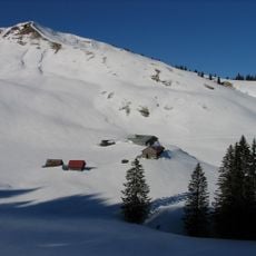
Almhütte „Herrnbauer“, erdgeschossiger verschindelter Blockbau über verputztem Bruchsteinsockel mit Satteldach, bezeichnet 1922
Location: Lenggries
Address: Rauhalm
GPS coordinates: 47.64921,11.64896
Latest update: November 24, 2025 08:36
Seekarkreuz
544 m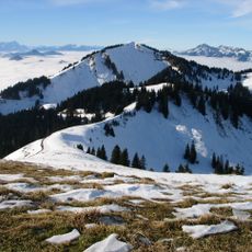
Schönberg
1.3 km
Hoch Platte
1.7 km
Kapelle und Kriegergedächtnisstätte
201 m
Spitzkamp
1.2 km
Brand Kopf
820 m
Mühltahleck
1.1 km
Zwiehof Rauhalm in Lenggries
272 m
Grasleiten-Kopf
1.5 km
Almhütte „Aschenlocher“
1.3 km
Alm
232 m
Almhütte „Zum Oberjäger“
2.1 km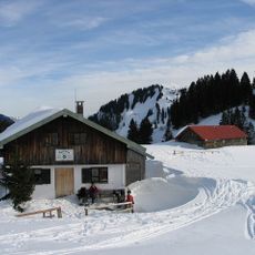
Almhütte „Zum Christof“
199 m
Almhütte „Zum Steinhauser“
284 m
Almhütte
1.2 km
Almhütte „Steffelbauer“
2.1 km
Almhütte „Lasslbauer“
2.1 km
Stallgebäude
1.2 km
Almhütte „Asenbauer“
1.2 km
Auerkamp
1.6 km
Wayside shrine
721 m
Wayside cross
1.6 km
Catholic church building, wayside cross, Christianity
998 m
Wayside cross
1.4 km
Hans Peter Worbs
1.1 km
Memorial, commemorative plaque
1.8 km
Waterfall
2 km
Waterfall
1.9 kmReviews
Visited this place? Tap the stars to rate it and share your experience / photos with the community! Try now! You can cancel it anytime.
Discover hidden gems everywhere you go!
From secret cafés to breathtaking viewpoints, skip the crowded tourist spots and find places that match your style. Our app makes it easy with voice search, smart filtering, route optimization, and insider tips from travelers worldwide. Download now for the complete mobile experience.

A unique approach to discovering new places❞
— Le Figaro
All the places worth exploring❞
— France Info
A tailor-made excursion in just a few clicks❞
— 20 Minutes