
Bildstock, gemauert mit spitzbogiger Nische, erste Hälfte 19. Jahrhundert; nördlich der Höfe
Location: Kraiburg
Address: Ensfelden 2
GPS coordinates: 48.19542,12.43391
Latest update: November 13, 2025 21:52
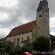
Church of the Ascension of Mary
865 m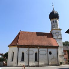
St. Nikolaus und Sebastian
1.3 km
Katholische Pfarrkirche St. Johann Baptist
1.3 km
Cultural heritage D-1-7740-0247 in Waldkraiburg
870 m
Cultural heritage D-1-7840-0033 in Kraiburg am Inn
1 km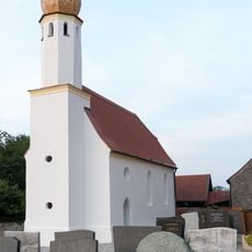
St. Michael
882 m
Cultural heritage D-1-7840-0032 in Kraiburg am Inn
850 m
Scheune Ensdorf 43 in Kraiburg am Inn
1.2 km
Katholische Pfarrhof mit Ökonomie
1.2 km
Cultural heritage D-1-7840-0001 in Waldkraiburg
1.2 km
Remise Ensdorf 43 in Kraiburg am Inn
1.2 km
Cultural heritage D-1-7740-0243 in Waldkraiburg
1.2 km
Unterbräu
1.3 km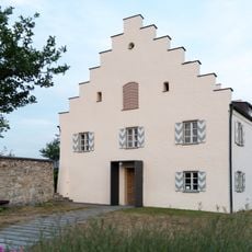
Pfarrhof
865 m
Kapelle
1 km
Cultural heritage D-1-7840-0190 in Kraiburg am Inn
1.3 km
Ehemaliges Bauernhaus
876 m
Friedhofsmauer Ensdorf 25 in Kraiburg am Inn
1.3 km
Stallstadel Ensdorf 43 in Kraiburg am Inn
1.2 km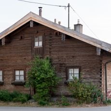
Kleinbauernhaus
933 m
Cultural heritage D-1-7840-0192 in Kraiburg am Inn
1.3 km
Inntal
1.3 km
Wayside cross
978 m
Wayside cross
1.3 km
Wayside cross
888 m
Wayside cross
1 km
Wayside shrine, Christianity
1.3 km
Wayside cross, Christianity
1.3 kmReviews
Visited this place? Tap the stars to rate it and share your experience / photos with the community! Try now! You can cancel it anytime.
Discover hidden gems everywhere you go!
From secret cafés to breathtaking viewpoints, skip the crowded tourist spots and find places that match your style. Our app makes it easy with voice search, smart filtering, route optimization, and insider tips from travelers worldwide. Download now for the complete mobile experience.

A unique approach to discovering new places❞
— Le Figaro
All the places worth exploring❞
— France Info
A tailor-made excursion in just a few clicks❞
— 20 Minutes