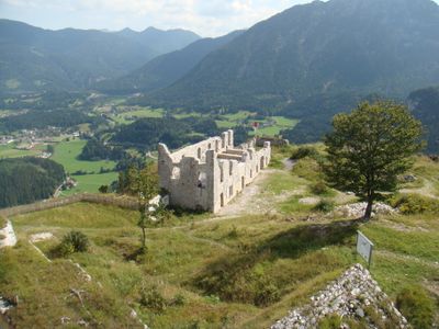
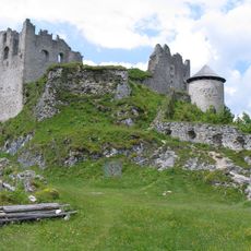
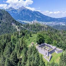
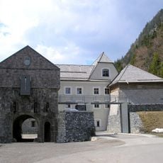
Festung Schlosskopf, Medieval fortress in Reutte, Austria.
Festung Schlosskopf is a fortified complex built on a hilltop ridge in Reutte, made up of several buildings and defensive walls. The layout includes watchtowers, covered gun positions, and bastions arranged to take advantage of the terrain for observation and protection.
The fortress was built in the 1730s to secure borders during that period and followed modern military engineering methods of the time. After a few decades, it lost its strategic importance and was gradually abandoned.
The fortress was part of a defensive network meant to protect the regional border, and its layout still shows how people organized military spaces back then. You can see how buildings were arranged to house soldiers and supplies.
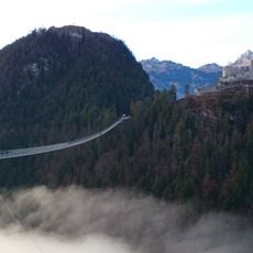
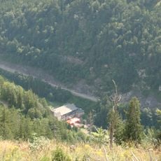
The path to the fortress follows a hiking trail from Reutte that climbs through wooded terrain with clear markings. You can also reach other nearby fortifications from here, making it easy to visit several sites in one trip.
A working Baroque-era crane still sits on the grounds, a rare example of how materials were lifted on building sites in that period. This device gives you a real sense of the tools soldiers and workers used daily.
Location: Reutte
GPS coordinates: 47.46440,10.71110
Latest update: December 8, 2025 21:05
Highline179
643 m
Ehrenberg Castle
537 m
Fort Claudia, Reutte
923 m
Wohnhaus Kaiser Lothar-Straße 6
2.4 km
Filialkirche Mariahilf, Höfen
2.1 km
Friedhof Wängle
2.5 km
Filialkirche Herz Mariae, Reutte
1.8 km
Kapelle bei der Ehrenberger Klause
553 m
Floriankapelle, Reutte
2.2 km
Herz-Jesu-Kapelle, Wängle
2.5 km
Ortskapelle Maria Hilf, Höfen
1.6 km
Kolomankapelle
2.1 km
Ortskapelle hl. Magnus, ehem. hl. Sebastian
1.1 km
Köpflehaus, Höfen
1.9 km
Brunnenfigur hl. Florian
2.2 km
Arma Christi cross
564 m
Salzstadel, Ehrenberger Klause
567 m
Bildstock Reuttener Straße, Ehenbichl
1.3 km
Volksschule Höfen
2.2 km
Gasthof Schwarzer Adler, Reutte
2.4 km
Außerfernbahn Klausentunnel
743 m
Crucifix Höfen
2.1 km
Südtiroler-Siedlung
2.5 km
Gasthof zur goldenen Krone
2.4 km
Bastion, Ehrenberger Klause
627 m
Ehrenberger Klause
551 m
Wegkreuz Krankenhausstraße
935 m
Ehem. Waisenhaus der Barmherzigen Schwestern
2.4 kmVisited this place? Tap the stars to rate it and share your experience / photos with the community! Try now! You can cancel it anytime.
Discover hidden gems everywhere you go!
From secret cafés to breathtaking viewpoints, skip the crowded tourist spots and find places that match your style. Our app makes it easy with voice search, smart filtering, route optimization, and insider tips from travelers worldwide. Download now for the complete mobile experience.
A unique approach to discovering new places❞
— Le Figaro
All the places worth exploring❞
— France Info
A tailor-made excursion in just a few clicks❞
— 20 Minutes