
Alpe Andlisbrongen, aline pasture in the municipality Egg in the Bregenzerwald in Vorarlberg, Austria
Location: Egg
Elevation above the sea: 1,212 m
GPS coordinates: 47.41043,9.96696
Latest update: March 3, 2025 02:33


Winterstaude
1.6 km
Seilbahn Bezau
4.5 km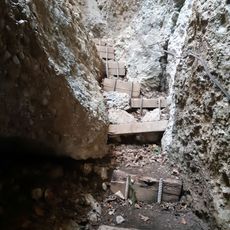
Natural monument Rappenfluh
4.2 km
Theodul-Kapelle Niedere
2.2 km
Kapelle Löffelau
4.4 km
Kapelle Hinteregg-Vorderteilvorsäß
3.8 km
Kapelle Hl. Sebastian,
4.6 km
Kapelle Vorsäß Mellenstock
4.6 km
Schetteregg
1.6 km
Alp Schreibere
2.4 km
Alp Stongen
2.1 km
Hintere Niedere
1.9 km
Vorsäss Sonderdach
3.3 km
Alp Lingenauere
2.1 km
Stongenhoehe
1.2 km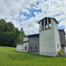
Church Ittensberg
2.4 km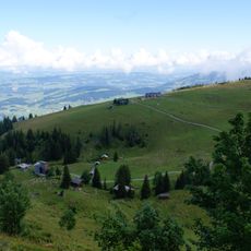
Alp Vordere Niedere
2.3 km
Alp Greussing Wildmoos
2.1 km
Alp Kassa Wildmoos
2.2 km
Alp Geserstobel
3.1 km
Alp Stoangerhoehe
1.6 km
Alp Helbocktobel
4.4 km
Alp Sammere
2.5 km
Bullerschkopf
3.2 km
Patennerkopf
3.5 km
Ehem. Schule und Mesnerhaus
4.6 km
Chapel Sonderdach
3.3 km
Alp Stenn
3.1 kmReviews
Visited this place? Tap the stars to rate it and share your experience / photos with the community! Try now! You can cancel it anytime.
Discover hidden gems everywhere you go!
From secret cafés to breathtaking viewpoints, skip the crowded tourist spots and find places that match your style. Our app makes it easy with voice search, smart filtering, route optimization, and insider tips from travelers worldwide. Download now for the complete mobile experience.

A unique approach to discovering new places❞
— Le Figaro
All the places worth exploring❞
— France Info
A tailor-made excursion in just a few clicks❞
— 20 Minutes