Bauernhaus, building in Ruhpolding, Upper Bavaria, Germany
Location: Ruhpolding
Address: Guglberg 1
GPS coordinates: 47.74863,12.63409
Latest update: January 22, 2024 08:44

Bauernhaus
941 m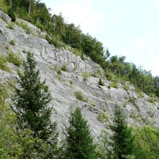
Steinbruch am Haßlberg bei Ruhpolding
430 m
Anbau zum Bauernhaus
32 m
Totenbretter am neuen Stadel
650 m
Bauernhaus
1 km
Bauernhaus
428 m
Wohnteil des Bauernhauses
1.1 km
Hochmoor E von Gstatt (Pfitzen)
806 m
Sogenannte Mühlbauernkapelle
992 m
Scheune
593 m
Bauernhaus
1.2 km
Bauernhaus
753 m
Bauernhaus
1 km
Bauernhaus
400 m
Bauernhaus
434 m
Bauernhaus
1.2 km
Breche Brander Straße 23 in Ruhpolding
928 m
Bauernhaus
706 m
Kleinbauernhaus
967 m
Bauernhaus
574 m
Bauernhaus
1 km
Bauernhaus
862 m
Anbau zum Bauernhaus
457 m
Bauernhaus
1.2 km
Catholic church building, wayside cross, Christianity
462 m
Catholic church building, wayside cross, Christianity
1.1 km
Kletterwald Ruhpolding
1.2 km
Catholic church building, wayside cross, Christianity
414 mReviews
Visited this place? Tap the stars to rate it and share your experience / photos with the community! Try now! You can cancel it anytime.
Discover hidden gems everywhere you go!
From secret cafés to breathtaking viewpoints, skip the crowded tourist spots and find places that match your style. Our app makes it easy with voice search, smart filtering, route optimization, and insider tips from travelers worldwide. Download now for the complete mobile experience.

A unique approach to discovering new places❞
— Le Figaro
All the places worth exploring❞
— France Info
A tailor-made excursion in just a few clicks❞
— 20 Minutes