Stadel, ständerbohlenbau mit Bundwerk und Steilsatteldach, Mitte 19. Jahrhundert
Location: Ampfing
Address: Ratzing 4
GPS coordinates: 48.28797,12.36161
Latest update: November 11, 2025 19:35

Nebenkirche St. Ulrich
429 m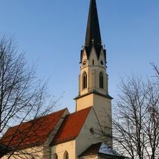
St. Stephan
1.2 km
Hofkapelle
821 m
Brunnenkapelle
414 m
Cultural heritage D-1-7740-0183 in Ampfing
2.1 km
Scheune Edgarten 1 in Ampfing
1.4 km
Cultural heritage D-1-7740-0186 in Ampfing
1.2 km
Nebengebäude In Stefanskirchen in Ampfing
1.2 km
Cultural heritage D-1-7740-0270 in Ampfing
2 km
Friedhof Salmanskirchen 6 in Ampfing
2.1 km
Bildstock
1.5 km
Ehemaliger Rossstall und Wirtschaftsgebäude des Gasthofs Stoiber
1.1 km
Friedhofsmauer Salmanskirchen 6 in Ampfing
2.1 km
Bildstock
529 m
Parallelhof
1.4 km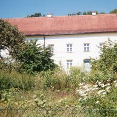
Ehemaliges Benefiziatenhaus, sogenanntes Oberes Schloss, jetzt Pfarrhaus
2 km
Friedhofsmauer Stefanusstraße 15 in Ampfing
1.2 km
Stadel
1.8 km
Wayside cross
1.2 km
Wayside cross
1.6 km
Wayside cross
2 km
Wayside cross
1.9 km
Wayside cross
1.2 km
Wayside shrine
1.5 km
Wayside cross
1.8 km
Wayside cross
1.9 kmReviews
Visited this place? Tap the stars to rate it and share your experience / photos with the community! Try now! You can cancel it anytime.
Discover hidden gems everywhere you go!
From secret cafés to breathtaking viewpoints, skip the crowded tourist spots and find places that match your style. Our app makes it easy with voice search, smart filtering, route optimization, and insider tips from travelers worldwide. Download now for the complete mobile experience.

A unique approach to discovering new places❞
— Le Figaro
All the places worth exploring❞
— France Info
A tailor-made excursion in just a few clicks❞
— 20 Minutes