
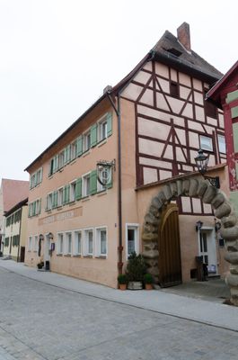
Hauptstraße 9, dreigeschossiges traufständiges Gebäude mit Halbwalmdach, seitlich Fachwerkobergeschoss, mit Laubengang, im Kern um 1500, Veränderungen 1621/23 (dendrochronologisch datiert) und 1852 (dendrochronologisch datiert)
Location: Wolframs-Eschenbach
Address: Hauptstraße 9
GPS coordinates: 49.22685,10.72415
Latest update: March 10, 2025 17:48

Deutschordensschloss
122 m
Liebfrauenmünster
157 m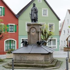
Wolfram von Eschenbach-Monument in Wolframs-Eschenbach
134 m
Hauptstraße 10
45 m
Hauptstraße 8
33 m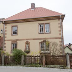
Färbergasse 17
132 m
Deutschordensstraße 5
98 m
Stadtmauer
127 m
Hauptstraße 16
89 m
Altes Rathaus
148 m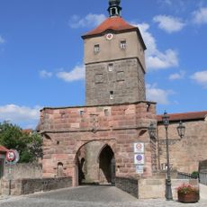
Oberes Tor (Wolframs-Eschenbach)
52 m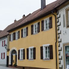
Hauptstraße 15
54 m
Ehemaliges Ackerbürgerhaus
89 m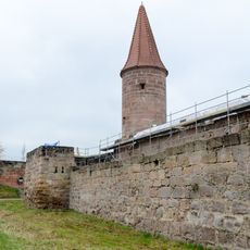
Sogenannter Bürgerturm
134 m
Hauptstraße 14
77 m
Zollhaus vor dem Oberen Tor
72 m
Fürstenherberge
70 m
Befestigungsturm, ehemaliger halbrunder Schalenturm der Nordwestbastion der Stadtbefestigung, zu Wohnhaus ausgebaut
139 m
Sogenannter Hungerturm
89 m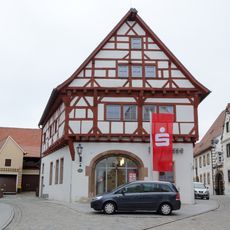
So-called High House
100 m
Ehemaliges Fürstengasthaus
70 m
Hauptstraße 13
42 m
Hauptstraße 4
27 m
Hauptstraße 5 (Wolframs-Eschenbach)
32 m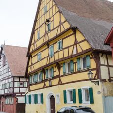
Hauptstraße 6
22 m
Hauptstraße 7
19 m
Hauptstraße 12
59 m
Hauptstraße 11 (Wolframs-Eschenbach)
20 mReviews
Visited this place? Tap the stars to rate it and share your experience / photos with the community! Try now! You can cancel it anytime.
Discover hidden gems everywhere you go!
From secret cafés to breathtaking viewpoints, skip the crowded tourist spots and find places that match your style. Our app makes it easy with voice search, smart filtering, route optimization, and insider tips from travelers worldwide. Download now for the complete mobile experience.

A unique approach to discovering new places❞
— Le Figaro
All the places worth exploring❞
— France Info
A tailor-made excursion in just a few clicks❞
— 20 Minutes