
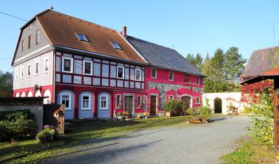
Harthe 4, Upper Lusatian house, outbuilding and barn in Seifhennersdorf
Location: Seifhennersdorf
Inception: 1892
Address: Harthe 4
GPS coordinates: 50.94461,14.62332
Latest update: April 20, 2025 19:51
Seifenteich
556 m
Mönchsbergweg 24
423 m
Leutersdorfer Straße 42
551 m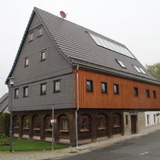
Oststraße 10
584 m
Mönchsbergweg 14
453 m
Harthe 8
95 m
Leutersdorfer Straße 37
552 m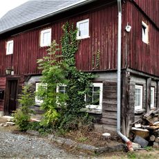
Leutersdorfer Straße 58
386 m
Leutersdorfer Straße 41
445 m
Leutersdorfer Straße 40
561 m
Mönchsbergweg 6
518 m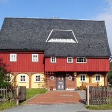
Leutersdorfer Straße 47
336 m
Leutersdorfer Straße 48
410 m
Leutersdorfer Straße 50
390 m
Leutersdorfer Straße 52
361 m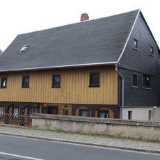
Leutersdorfer Straße 35
581 m
Mönchsbergweg 1
370 m
Mönchsbergweg 3
379 m
Leutersdorfer Straße 43
447 m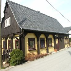
Mönchsbergweg 7
430 m
Mönchsbergweg 12
439 m
Harthe 7
112 m
Mönchsbergweg 18
400 m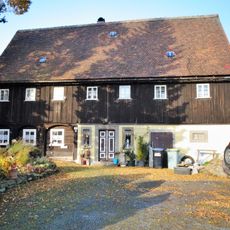
Harthe 5
167 m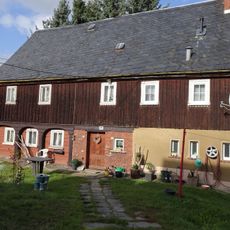
Mönchsbergweg 26
405 m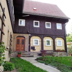
Mönchsbergweg 28
424 m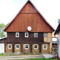
Mönchsbergweg 36
489 m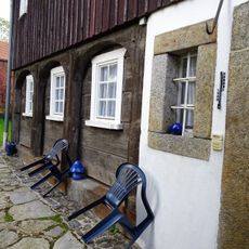
Mönchsbergweg 40
478 mReviews
Visited this place? Tap the stars to rate it and share your experience / photos with the community! Try now! You can cancel it anytime.
Discover hidden gems everywhere you go!
From secret cafés to breathtaking viewpoints, skip the crowded tourist spots and find places that match your style. Our app makes it easy with voice search, smart filtering, route optimization, and insider tips from travelers worldwide. Download now for the complete mobile experience.

A unique approach to discovering new places❞
— Le Figaro
All the places worth exploring❞
— France Info
A tailor-made excursion in just a few clicks❞
— 20 Minutes