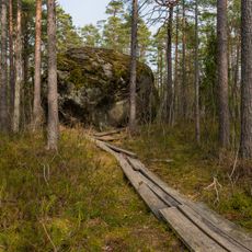
Koljuvare
Location: Kuusalu Rural Municipality
GPS coordinates: 59.64760,25.50843
Latest update: November 24, 2023 22:35
Majakivi
8.1 km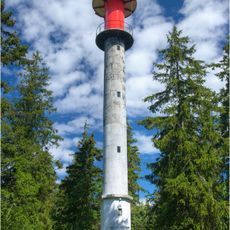
Juminda Lighthouse
148 m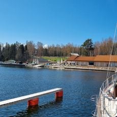
Hara Allveelavade Sadam
9 km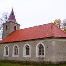
Leesi Church
4.4 km
Odakivi
9.8 km
Juminda Cemetery
942 m
Purekari rändrahn
10.9 km
Jaani-Mardi Suurkivi
13.5 km
Leesi Churchyard
4.4 km
Scenic viewpoint, tower, Observation tower
8.7 km
Juminda esimene kabel 1579
523 m
Scenic viewpoint
3.1 km
Kolga-Aabla beach
8.2 km
Imutaja beach
1.3 km
Hara Submarine base
8.8 km
Former soviet submarine degaussing station
8.8 km
Kura beach
996 m
Pähkneeme beach
9.5 km
Tower, Observation tower, scenic viewpoint
5.4 km
Mere miinid
121 m
Pedaspea beach
11.6 km
Loksa laevatehase ja tellisevabriku hooned
13.2 km
Loksa beach
13.4 km
Juminda mine battle
114 m
Obelisk, memorial
13.5 km
Monument
13.6 km
Work of art, sculpture
13.7 km
Viinistu katlamaja
13.7 kmReviews
Visited this place? Tap the stars to rate it and share your experience / photos with the community! Try now! You can cancel it anytime.
Discover hidden gems everywhere you go!
From secret cafés to breathtaking viewpoints, skip the crowded tourist spots and find places that match your style. Our app makes it easy with voice search, smart filtering, route optimization, and insider tips from travelers worldwide. Download now for the complete mobile experience.

A unique approach to discovering new places❞
— Le Figaro
All the places worth exploring❞
— France Info
A tailor-made excursion in just a few clicks❞
— 20 Minutes