Roc de Peralta, mountain in Spain
Location: Les Valls d'Aguilar
Elevation above the sea: 1,057.7 m
GPS coordinates: 42.29078,1.28341
Latest update: November 19, 2025 04:09
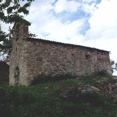
Santa Elena de Trejuvell
955 m
Sant Lluc d'Anyús
2.6 km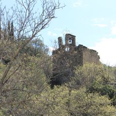
Santa Llogaia de Bellpui
2.8 km
Sant Quirí i Santa Julita de Berén
2.2 km
Sant Martí de Berén
3.7 km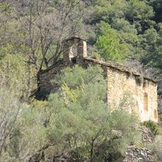
Sant Bartomeu de Malgrat
2.1 km
Concepció de Miravall
3.4 km
Sant Esteve de la Guàrdia d'Ares
3.9 km
El Castellot
2.9 km
La Moixella
3.2 km
Montcau
2.3 km
Cap de Pla Redon
2.2 km
Molins de l'Esparrica
3.1 km
El Picalt
3.3 km
La Peralta de Dalt
745 m
Santalís
3.1 km
Pont de Miravall
2.8 km
Roc de les Gralles
2.6 km
Pont de Guils
3.8 km
Dolmen de Conorbau
3.1 km
Església parroquial de Sant Antoni
3.8 km
Pont de la Capella
3.3 km
Església parroquial de Santa Eulàlia
2.6 km
L'Escalella
3.7 km
Pont de Carrallonga
1.6 km
Molí del Mestre
3.4 km
Catholic church building, wayside cross
2.2 km
Ruins
2.8 kmReviews
Visited this place? Tap the stars to rate it and share your experience / photos with the community! Try now! You can cancel it anytime.
Discover hidden gems everywhere you go!
From secret cafés to breathtaking viewpoints, skip the crowded tourist spots and find places that match your style. Our app makes it easy with voice search, smart filtering, route optimization, and insider tips from travelers worldwide. Download now for the complete mobile experience.

A unique approach to discovering new places❞
— Le Figaro
All the places worth exploring❞
— France Info
A tailor-made excursion in just a few clicks❞
— 20 Minutes