Stavasselva, protected area in Norway
Location: Grane Municipality
GPS coordinates: 65.50000,13.35500
Latest update: November 4, 2025 08:41
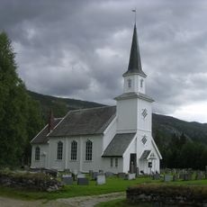
Grane Church
9.4 km
Båfjellmobrua
4.3 km
Mølnhusforsen
7.3 km
Skarforsen
5 km
Nonstindan
10.4 km
Fellingforsen
8.2 km
Tjuvholforsen
11.3 km
Sirijorda
9.4 km
Geitklauvmyra
11.9 km
Forradalen
13.3 km
Almdalsforsen
13.8 km
Dalforsen
12.7 km
Langskardnasen
10.9 km
Sandervelta
6 km
Bergverk-gruveanlegg
3.2 km
Falkfloget
7.8 km
Scenic viewpoint
535 m
Scenic viewpoint
412 m
Fellingforsen
8.2 km
Storforsen
5.3 km
Kvannholstryket
2.6 km
Tjuvholforsen
11.3 km
Dalforsen
12.7 km
Storforsen
1.9 km
Mølnhusforsen
7.3 km
Skardforsen
5 km
Waterfall
1.2 km
Waterfall
1.2 kmReviews
Visited this place? Tap the stars to rate it and share your experience / photos with the community! Try now! You can cancel it anytime.
Discover hidden gems everywhere you go!
From secret cafés to breathtaking viewpoints, skip the crowded tourist spots and find places that match your style. Our app makes it easy with voice search, smart filtering, route optimization, and insider tips from travelers worldwide. Download now for the complete mobile experience.

A unique approach to discovering new places❞
— Le Figaro
All the places worth exploring❞
— France Info
A tailor-made excursion in just a few clicks❞
— 20 Minutes