Kleppsstølsvatnet, protected area in Norway
Location: Sunnfjord Municipality
GPS coordinates: 61.52800,5.84400
Latest update: November 4, 2025 08:35

Kvamsfossen
7.8 km
Lonefossen
716 m
Høgefossen
3.2 km
Styggelifossen
5.8 km
Grønøyra
6.8 km
Bolteheia
7.2 km
Sollifossen
1.1 km
Naustdalsfossen
6.7 km
Rotenesstølen
3.4 km
Friisgården
7.2 km
Falchensten Falkenstein
8 km
Steinbrudd
7.8 km
Bakkestølen, lok 117
6.2 km
Førdsnipa
6.1 km
Ekrestølen, lok 118
7.2 km
Fetts fk.nr. 1
5.4 km
Klopstadstølen
3.5 km
Tuftene
4.9 km
Nordstølen, lok 121
7.3 km
Hovskletten, lok 122
5.3 km
Hovskletten, lok 123
5.3 km
Hovskletten, lok 124
5.1 km
Vegastølen, lok 120
6.4 km
Slåttestøylen
6.6 km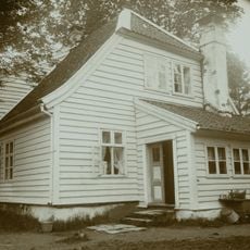
KIRKEVOLDEN
8.1 km
Fetts fk. nr. 1/3
7.7 km
Installation artwork, Work of art
7.2 km
Work of art, installation artwork
7.2 kmReviews
Visited this place? Tap the stars to rate it and share your experience / photos with the community! Try now! You can cancel it anytime.
Discover hidden gems everywhere you go!
From secret cafés to breathtaking viewpoints, skip the crowded tourist spots and find places that match your style. Our app makes it easy with voice search, smart filtering, route optimization, and insider tips from travelers worldwide. Download now for the complete mobile experience.

A unique approach to discovering new places❞
— Le Figaro
All the places worth exploring❞
— France Info
A tailor-made excursion in just a few clicks❞
— 20 Minutes