Heigremyra, protected area in Norway
Location: Sandnes Municipality
GPS coordinates: 58.84600,5.63700
Latest update: November 4, 2025 06:54
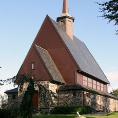
Julebygda Chapel
2.3 km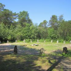
Domsteinane
3.4 km
Rogaland Krigshistoriske Museum
3.2 km
Rægehaugene
2.4 km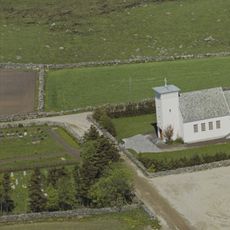
Ræge kapell
1.9 km
Harvalandsvatnet
3.6 km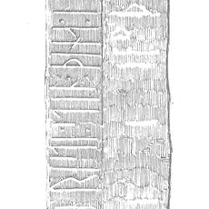
Runenstein von Helland
3 km
Kråkhaug II
2.9 km
Byberg
3.8 km
Hedland
3.4 km
Gimra
1.1 km
Valhaug 1
3 km
Ølberg
3.4 km
Ølbør III
3.7 km
Tjelta
1.8 km
Valhaug 3
3 km
Hedland
3.3 km
Gimra
987 m
Tjelta
2.1 km
Gimra
1.1 km
Kråkhaug I
3 km
Regehaugene
2.4 km
ØLBERGSKOGEN
3.2 km
Ølberg
3.6 km
Valhaug 2
2.7 km
Ølbør I
3.7 km
Domsteinane på Sola
3.4 km
Work of art
1.2 kmReviews
Visited this place? Tap the stars to rate it and share your experience / photos with the community! Try now! You can cancel it anytime.
Discover hidden gems everywhere you go!
From secret cafés to breathtaking viewpoints, skip the crowded tourist spots and find places that match your style. Our app makes it easy with voice search, smart filtering, route optimization, and insider tips from travelers worldwide. Download now for the complete mobile experience.

A unique approach to discovering new places❞
— Le Figaro
All the places worth exploring❞
— France Info
A tailor-made excursion in just a few clicks❞
— 20 Minutes