Langøy kyrkjegard, gravlund i Kragerø
Location: Porsanger Municipality
GPS coordinates: 70.49282,25.31984
Latest update: November 16, 2025 01:07
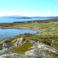
Porsanger Fjord
19.1 km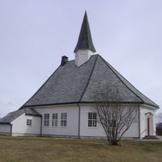
Børselv Church
21.2 km
Børselvdalen
20.8 km
Bihkkacohkka
19.6 km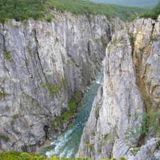
Silfarfossen
21.2 km
Ruođugáddi
19 km
Brennelvfossen
11.1 km
Jaakonkari
15.6 km
Gorbovuongorŋi
20.1 km
Kappa
7.8 km
Gorbovuongorži
20.1 km
Annen bygningslokalitet
19.8 km
Vilgesčohkka
20.2 km
Børselv
21.2 km
Siehvaara
20.2 km
Storkappa
7.8 km
Kirkeneset/Girkunjarga
5.3 km
Rituell-kultisk lokalitet
20.9 km
Skinski-bukta
14.9 km
Kistrandnes kirkegård
4.3 km
Leirpollen gravplass
14.1 km
Silfar Canyon
20.2 km
Scenic viewpoint
20.4 km
Scenic viewpoint
21 km
Brennelvfossen
11.1 km
Silffargorži - Silfarfossen - Silfarinkurkkii
21.1 km
Saunomakurkkii
14.2 km
Gorbovuongorži
20.1 kmReviews
Visited this place? Tap the stars to rate it and share your experience / photos with the community! Try now! You can cancel it anytime.
Discover hidden gems everywhere you go!
From secret cafés to breathtaking viewpoints, skip the crowded tourist spots and find places that match your style. Our app makes it easy with voice search, smart filtering, route optimization, and insider tips from travelers worldwide. Download now for the complete mobile experience.

A unique approach to discovering new places❞
— Le Figaro
All the places worth exploring❞
— France Info
A tailor-made excursion in just a few clicks❞
— 20 Minutes