Elvedalen meieri
Location: Gjøvik Municipality
GPS coordinates: 60.87676,10.44579
Latest update: November 4, 2025 12:34
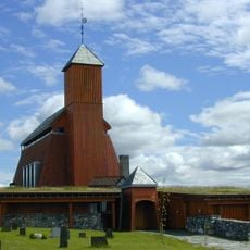
Seegård Church
995 m
Øytjernet
4.5 km
Ringsjødammen
2.4 km
Skonnord-dammen
3.5 km
Sag og stampemølle med fargestue, Rubbesvebekken
3.2 km
Fredrikstuen meieri
4.7 km
Tofsrud Kalkovn
4.1 km
Kvisgard sag
2.1 km
Snartum Kraftverk
3.5 km
Snartum sag
1.9 km
Øvre Nøss sag og mølle
1.8 km
Berg kvern og sag
3.1 km
Tømmeråsen kvern og sag
818 m
Vannrenne til Snartum Kvern
2.3 km
Skonnord sag og kvern
3.3 km
Seegard kvern og sag
551 m
Rådalen Teglverk
1.5 km
Kvisgard kvern
1.7 km
Nettåsen kvern og sag
3.8 km
Nøss Knottfabrikk
1.7 km
Kalkovn, Bjerkås under Gjøsti
2.4 km
Sag eller kvern, Drogseth
2.7 km
Mur, Nye Snartum bru
3.2 km
Hovstueekeren
3.7 km
Drogseth sag og mølle
3.3 km
Bekkekvern, Onsrud
4.6 km
Tofsrud sag
4.4 km
Drogsethaugen
4.3 kmReviews
Visited this place? Tap the stars to rate it and share your experience / photos with the community! Try now! You can cancel it anytime.
Discover hidden gems everywhere you go!
From secret cafés to breathtaking viewpoints, skip the crowded tourist spots and find places that match your style. Our app makes it easy with voice search, smart filtering, route optimization, and insider tips from travelers worldwide. Download now for the complete mobile experience.

A unique approach to discovering new places❞
— Le Figaro
All the places worth exploring❞
— France Info
A tailor-made excursion in just a few clicks❞
— 20 Minutes