Holmendammen
Location: Østre Toten Municipality
GPS coordinates: 60.60939,10.75776
Latest update: November 5, 2025 01:58
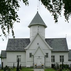
Kolbu Church
2.4 km
Demning, Molstad
2.1 km
Demning, Røyse
1.6 km
Kvernveit, Molstad
2.3 km
Kvikstad søndre
1 km
Kvernveit, Bråstaddalen
255 m
Kvernveit, Røyse
1.7 km
Teglverk og Frørenseri
484 m
Kvernveit, Molstad
2.3 km
Bråstad Meieri
331 m
Evendammen
516 m
Mølledammen
243 m
Fjølstaddammen
641 m
Fargerhaugen
189 m
Nedre Kvikstadbruket
105 m
Demning, Bråstaddalen
295 m
Demning, Bråstaddalen
444 m
Kvernveit, Molstad
2.1 km
Øvre Kvikstadbruket
294 m
Kvernveit, Bråstaddalen
748 m
Fjølstadbruket mølle
814 m
Smiedammen
107 m
Renseridammen
383 m
Bråstad Mølle
289 m
Kvernveit, Bråstaddalen
340 m
Mølle og sagbruk, Røyse
1.7 km
Mølle, Molstad
2.3 km
Kvikstad nordre
2.1 kmReviews
Visited this place? Tap the stars to rate it and share your experience / photos with the community! Try now! You can cancel it anytime.
Discover hidden gems everywhere you go!
From secret cafés to breathtaking viewpoints, skip the crowded tourist spots and find places that match your style. Our app makes it easy with voice search, smart filtering, route optimization, and insider tips from travelers worldwide. Download now for the complete mobile experience.

A unique approach to discovering new places❞
— Le Figaro
All the places worth exploring❞
— France Info
A tailor-made excursion in just a few clicks❞
— 20 Minutes