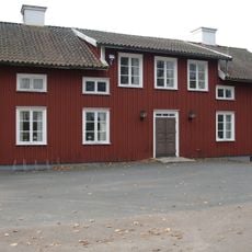
Reftele 66:2, building in Gislaved Municipality, Jönköping County, Sweden
Location: Gislaved Municipality
GPS coordinates: 57.20891,13.61161
Latest update: November 15, 2025 13:35
Reftele municipality
3.9 km
Reftele GK
838 m
Nennesmo
4.2 km
Västbo tingslag
3.9 km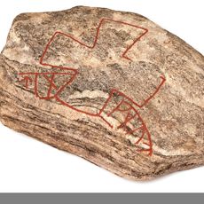
Smålands runinskrifter NOR2002;25
4.5 km
Långesten
535 m
Reftele 25:2
3.7 km
Brödrahallar
3.8 km
Brödrahallar
3.8 km
Reftele 26:1
4.2 km
Brödrahallar
3.8 km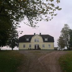
Ölmestads museum
4.3 km
Reftele 25:1
3.7 km
Reftele 66:1
11 m
Reftele 4:1
3.2 km
Reftele 422:1
5.1 km
Reftele 545:1
2.9 km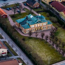
Västbo härads tingshus
3.9 km
Reftele 16:3
4.6 km
Reftele 16:2
4.6 km
Reftele 50:1
5.1 km
Kungsstenen
2.4 km
Reftele 11:1
4 km
Reftele 16:1
4.6 km
Reftele 21:1
4.2 km
Reftele 512:1
4.3 km
Grysjö Kulle
4.5 km
Källebackens golfbana
770 mReviews
Visited this place? Tap the stars to rate it and share your experience / photos with the community! Try now! You can cancel it anytime.
Discover hidden gems everywhere you go!
From secret cafés to breathtaking viewpoints, skip the crowded tourist spots and find places that match your style. Our app makes it easy with voice search, smart filtering, route optimization, and insider tips from travelers worldwide. Download now for the complete mobile experience.

A unique approach to discovering new places❞
— Le Figaro
All the places worth exploring❞
— France Info
A tailor-made excursion in just a few clicks❞
— 20 Minutes