Åker 20:1, stenkrets i Småland
Location: Vaggeryd Municipality
GPS coordinates: 57.40779,13.96761
Latest update: November 21, 2025 08:26
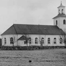
Åkers kyrka, Småland
3.5 km
Mässeberg
3.6 km
Marieholmsskogen
5 km
Åker 54:3
907 m
Åker 140:1
1.5 km
Åker 33:2
3.3 km
Sm 65, Åkers prästgård
3.3 km
Åker 54:2
934 m
Åker 26:1
2.1 km
Åker 55:1
1.8 km
Åker 55:3
1.7 km
Åker 124:1
3.2 km
Åker 254
5.7 km
Åker 121:1
4.8 km
Kävsjö 34:1
5.9 km
Åker 122:1
4.6 km
Åker 113:1
5.9 km
Åker 54:1
924 m
Ekekullen
4 km
Fredsröset
2.1 km
Åker 247
4.6 km
Åker 120:1
4.1 km
Åker 136:1
5.8 km
Åker 33:1
3.3 km
Åker 31:1
1.9 km
Åker 30:1
1.7 km
Åker 27:1
3 km
Prinsgraven
1.7 kmReviews
Visited this place? Tap the stars to rate it and share your experience / photos with the community! Try now! You can cancel it anytime.
Discover hidden gems everywhere you go!
From secret cafés to breathtaking viewpoints, skip the crowded tourist spots and find places that match your style. Our app makes it easy with voice search, smart filtering, route optimization, and insider tips from travelers worldwide. Download now for the complete mobile experience.

A unique approach to discovering new places❞
— Le Figaro
All the places worth exploring❞
— France Info
A tailor-made excursion in just a few clicks❞
— 20 Minutes