Tannåker 22:1, röse i Småland
Location: Ljungby Municipality
GPS coordinates: 56.98535,13.78200
Latest update: October 25, 2025 15:24
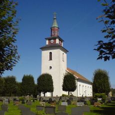
Bolmsö Church
4.3 km
Bolmsö 200:1
2.7 km
Vittaryd 1:1
4.1 km
Bolmsö 148:1
7 km
Bolmsö 147:1
5.9 km
Bolmsö 17:1
2.4 km
Penningröret
5.1 km
Bolmsö 90:1
6.6 km
Bolmsö 95:1
2.4 km
Dannäs 60:1
7 km
Bolmsö 110:1
3.6 km
Bolmsö 99:1
3.4 km
Bolmsö 133:1
2.2 km
Bolmsö 70:1
5.6 km
Vita rör
4.1 km
Bolmsö 91:1
6.7 km
Bolmsö 39:1
4 km
Bolmsö 97:1
2.9 km
Kung Rings sten
3.4 km
Bolmsö 31:1
2.3 km
Bolmsö 1:2
3.2 km
Tannåker 13:1
2.9 km
Tannåker 12:1
2.9 km
Bolmsö 186:1
3.8 km
Bolmsö 199:1
2.7 km
Bolmsö 19:1
1.8 km
Bolmsö 200:2
2.7 km
Bolmsö 202:1
3.7 kmReviews
Visited this place? Tap the stars to rate it and share your experience / photos with the community! Try now! You can cancel it anytime.
Discover hidden gems everywhere you go!
From secret cafés to breathtaking viewpoints, skip the crowded tourist spots and find places that match your style. Our app makes it easy with voice search, smart filtering, route optimization, and insider tips from travelers worldwide. Download now for the complete mobile experience.

A unique approach to discovering new places❞
— Le Figaro
All the places worth exploring❞
— France Info
A tailor-made excursion in just a few clicks❞
— 20 Minutes