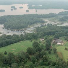
Virestad 39:1, röse i Småland
Location: Älmhult Municipality
GPS coordinates: 56.65654,14.34250
Latest update: October 29, 2025 03:18
Höö
10.1 km
Stubbalyckeboken, Stubbalycke 1:2
4.3 km
En solitärek, Spånghultseken
1.8 km
Två ekar, Virestadsekarna
3.8 km
Virestad 263:1
1.3 km
Virestad 300:1
2.5 km
Virestad 30:1
1.3 km
Virestad 606
4.9 km
Virestad 290:1
3.5 km
Virestad 264:1
1.3 km
Virestad 260:2
1.5 km
Virestad 597
5.2 km
Virestad 13:1
4.7 km
Virestad 30:2
1.3 km
Virestad 259:1
1 km
Agunnaryd 22:1
9.5 km
Stenbrohult 175:1
9.4 km
Virestad 256:1
478 m
Stenbrohult 289
9.6 km
Stenbrohult 60:1
9.6 km
Stenbrohult 290
9.6 km
Virestad 29:1
5 km
Stenbrohult 241
7.1 km
Stenbrohult 173:1
9.6 km
Drakarör
6.6 km
Virestad 302:1
4.9 km
Virestad 163:1
8.8 km
Virestad 103:2
1.5 kmReviews
Visited this place? Tap the stars to rate it and share your experience / photos with the community! Try now! You can cancel it anytime.
Discover hidden gems everywhere you go!
From secret cafés to breathtaking viewpoints, skip the crowded tourist spots and find places that match your style. Our app makes it easy with voice search, smart filtering, route optimization, and insider tips from travelers worldwide. Download now for the complete mobile experience.

A unique approach to discovering new places❞
— Le Figaro
All the places worth exploring❞
— France Info
A tailor-made excursion in just a few clicks❞
— 20 Minutes