Hietaniemi 281:1, husgrund, historisk tid i Norrbotten
Location: Övertorneå Municipality
GPS coordinates: 66.08622,23.33246
Latest update: November 9, 2025 21:53

Kalix kopparbruk
8.6 km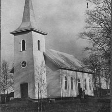
Björkfors kyrka
19.2 km
Moån
9.6 km
Tällberget
17.1 km
Asumamaa
14.8 km
Nederkalix 257:2
16.5 km
Nederkalix 107:1
16.4 km
Nederkalix 108:3
18.4 km
Nederkalix 91:1
15.1 km
Nederkalix 108:2
18.4 km
Nederkalix 441:2
7.9 km
Karl Gustav 61:1
9.4 km
Nederkalix 98:1
14.3 km
Nederkalix 97:1
13.4 km
Karl Gustav 60:4
9.3 km
Nedertorneå 355:1
17.5 km
Espinärahögen
15.2 km
Töre 50:1
21.6 km
Nederkalix 680:1
21.1 km
Nederkalix 514:2
13 km
Nederkalix 442:2
8.4 km
Nederkalix 108:1
18.4 km
Nederkalix 441:1
7.9 km
Nederkalix 257:3
16.5 km
Nederkalix 257:1
16.5 km
Karl Gustav 60:3
9.3 km
Karl Gustav 60:2
9.3 km
Karl Gustav 60:1
9.3 kmReviews
Visited this place? Tap the stars to rate it and share your experience / photos with the community! Try now! You can cancel it anytime.
Discover hidden gems everywhere you go!
From secret cafés to breathtaking viewpoints, skip the crowded tourist spots and find places that match your style. Our app makes it easy with voice search, smart filtering, route optimization, and insider tips from travelers worldwide. Download now for the complete mobile experience.

A unique approach to discovering new places❞
— Le Figaro
All the places worth exploring❞
— France Info
A tailor-made excursion in just a few clicks❞
— 20 Minutes