Skepplanda 134:1, hällristning i Västergötland
Location: Ale Municipality
GPS coordinates: 57.98168,12.15577
Latest update: November 24, 2023 23:10
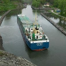
Trollhätte Canal
2.7 km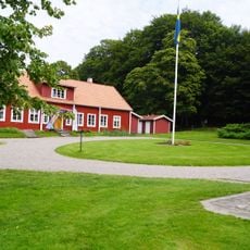
Alvhems kungsgård
2.5 km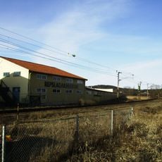
P. A. Carlmarks repslageri
2.8 km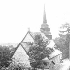
Norrmannebo kapell
2.9 km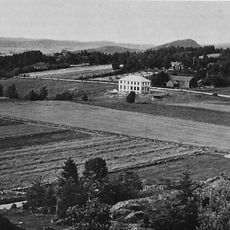
Ramstorp Jätteberget
2 km
Skönningared
1.4 km
Kungsgraven
2.6 km
Smörkullen
2 km
Skepplanda 101:1
2.5 km
Skepplanda hemvärns- och kulturförening, militärhistoriskt museum
2.8 km
Smedshögen
1.9 km
Skepplanda 17:1
1.4 km
Skepplanda 186:3
369 m
Skepplanda 133:1
311 m
Skepplanda 123:1
680 m
Starrkärr 100:1
2.9 km
Skepplanda 143:1
2.7 km
Skepplanda 13:1
2.2 km
Skepplanda 36:1
2.9 km
Skepplanda 140:1
2.6 km
Skepplanda 39:1
1.8 km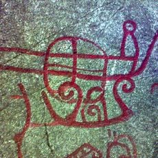
Skepplanda 56:1
2.6 km
Skepplanda 8:1
2.6 km
Skepplanda 29:1
2.9 km
Skepplanda 1:1
1.5 km
Skepplanda 220
1.4 km
Skepplanda 55:1
2.5 km
Skepplanda 3:1
1.2 kmReviews
Visited this place? Tap the stars to rate it and share your experience / photos with the community! Try now! You can cancel it anytime.
Discover hidden gems everywhere you go!
From secret cafés to breathtaking viewpoints, skip the crowded tourist spots and find places that match your style. Our app makes it easy with voice search, smart filtering, route optimization, and insider tips from travelers worldwide. Download now for the complete mobile experience.

A unique approach to discovering new places❞
— Le Figaro
All the places worth exploring❞
— France Info
A tailor-made excursion in just a few clicks❞
— 20 Minutes