Håle 27:1, stenkrets i Västergötland
Location: Grästorp Municipality
GPS coordinates: 58.37465,12.77371
Latest update: October 26, 2025 06:09
Särestad-Bjärby Church
2.2 km
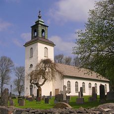
Håle gamle Kirke
872 m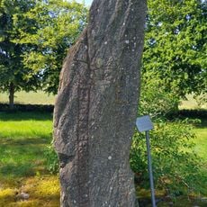
Västergötlands runinskrifter 102
871 m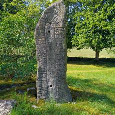
Västergötlands runinskrifter 103
875 m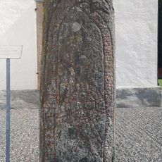
Västergötlands runinskrifter 105
2.2 km
Särestad 11:1
2.6 km
Särestad 13:1
3 km
Särestad 71:1
1.6 km
Håle 22:1
2.1 km
Täng 53:1
2.7 km
Flakeberg 36:1
2.2 km
Särestad 62:1
2.8 km
Särestad 37:1
3 km
Täng 57:1
2.6 km
Särestad 13:2
3 km
Särestad 15:1
2.9 km
Särestad 20:1
2.2 km
Särestad 55:1
3 km
Särestad 56:1
2.7 km
Särestad 57:1
2.3 km
Särestad 5:3
3 km
Särestad 61:1
2.8 km
Särestad 58:1
2.5 km
Särestad 63:1
3 km
Särestad 35:1
3 km
Särestad 83:1
2.1 km
Särestad 20:2
2.2 km
Håle 35:1
977 mReviews
Visited this place? Tap the stars to rate it and share your experience / photos with the community! Try now! You can cancel it anytime.
Discover hidden gems everywhere you go!
From secret cafés to breathtaking viewpoints, skip the crowded tourist spots and find places that match your style. Our app makes it easy with voice search, smart filtering, route optimization, and insider tips from travelers worldwide. Download now for the complete mobile experience.

A unique approach to discovering new places❞
— Le Figaro
All the places worth exploring❞
— France Info
A tailor-made excursion in just a few clicks❞
— 20 Minutes