Tanum 254:1, hällristning i Bohuslän
Location: Tanum Municipality
GPS coordinates: 58.72223,11.37811
Latest update: November 24, 2025 04:31
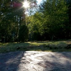
Rock carvings at Fossum
394 m
Tanum 378:2
244 m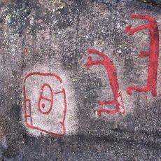
Tanum 149:1
442 m
Tanum 600:1
551 m
Tanum 152:1
567 m
Tanum 378:3
237 m
Tanum 378:1
246 m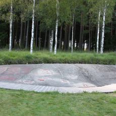
Tanum 255:1
392 m
Tanum 256:1
324 m
Tanum 370:2
152 m
Tanum 283:1
522 m
Tanum 874:1
416 m
Tanum 253:1
21 m
Tanum 371:1
431 m
Tanum 259:1
225 m
Tanum 370:1
150 m
Tanum 284:1
542 m
Tanum 285:1
511 m
Tanum 260:2
336 m
Tanum 260:1
353 m
Tanum 370:3
147 m
Tanum 263:1
549 m
Tanum 261:1
422 m
Tanum 157:1
401 m
Tanum 156:1
287 m
Tanum 151:1
355 m
Tanum 840:1
96 m
Tanum 840:2
102 mReviews
Visited this place? Tap the stars to rate it and share your experience / photos with the community! Try now! You can cancel it anytime.
Discover hidden gems everywhere you go!
From secret cafés to breathtaking viewpoints, skip the crowded tourist spots and find places that match your style. Our app makes it easy with voice search, smart filtering, route optimization, and insider tips from travelers worldwide. Download now for the complete mobile experience.

A unique approach to discovering new places❞
— Le Figaro
All the places worth exploring❞
— France Info
A tailor-made excursion in just a few clicks❞
— 20 Minutes