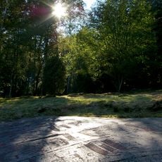
Tanum 272:1, hällristning i Bohuslän
Location: Tanum Municipality
GPS coordinates: 58.72928,11.39099
Latest update: November 15, 2025 08:09
Rock carvings at Fossum
701 m
Tanum 375:2
387 m
Tanum 1357:1
871 m
Tanum 397:1
585 m
Tanum 372:1
634 m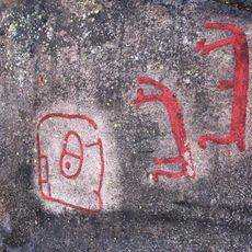
Tanum 149:1
650 m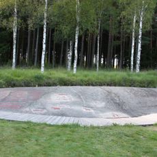
Tanum 255:1
706 m
Tanum 256:1
772 m
Tanum 374:1
361 m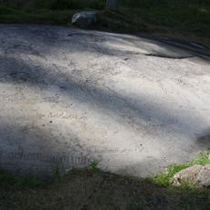
Tanum 262:1
521 m
Tanum 1368:1
500 m
Tanum 802:1
474 m
Tanum 371:1
830 m
Tanum 267:1
350 m
Tanum 268:1
278 m
Tanum 269:1
229 m
Tanum 273:1
322 m
Tanum 259:1
867 m
Tanum 264:2
461 m
Tanum 264:1
449 m
Tanum 801:1
256 m
Tanum 263:1
535 m
Tanum 266:1
358 m
Tanum 261:1
672 m
Tanum 260:2
772 m
Tanum 375:1
410 m
Tanum 260:1
754 m
Tanum 274:1
519 mReviews
Visited this place? Tap the stars to rate it and share your experience / photos with the community! Try now! You can cancel it anytime.
Discover hidden gems everywhere you go!
From secret cafés to breathtaking viewpoints, skip the crowded tourist spots and find places that match your style. Our app makes it easy with voice search, smart filtering, route optimization, and insider tips from travelers worldwide. Download now for the complete mobile experience.

A unique approach to discovering new places❞
— Le Figaro
All the places worth exploring❞
— France Info
A tailor-made excursion in just a few clicks❞
— 20 Minutes