Stavnäs 82:3, stone setting in Värmland, Sweden
Location: Arvika Municipality
GPS coordinates: 59.54012,12.76608
Latest update: October 27, 2025 07:43
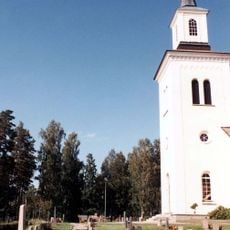
Högeruds kyrka
5 km
Stavnäs 6:1
5.4 km
Stavnäs 41:1
5.3 km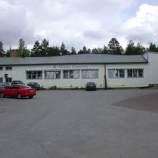
Klässbols linneväveri
1.5 km
Stavnäs 40:1
5.3 km
Stavnäs 43:2
5.3 km
Högerud 13:2
4 km
Stavnäs 49:1
5.1 km
Stavnäs 49:3
5.1 km
Stavnäs 19:1
3.2 km
Stavnäs 50:3
5.1 km
Högerud 13:1
3.9 km
Stavnäs 43:1
5.3 km
Stavnäs 18:1
1.9 km
Stavnäs 4:1
5 km
Stavnäs 50:1
5.1 km
Stavnäs 46:1
5.1 km
Stavnäs 3:1
4.5 km
Stavnäs 44:1
5.1 km
Stavnäs 45:1
5.1 km
Stavnäs 33:1
4.2 km
Stavnäs 2:1
4.4 km
Stavnäs 49:2
5.1 km
Stavnäs 19:3
3.2 km
Stavnäs 42:1
5.3 km
Stavnäs 50:2
5.1 km
Stavnäs 19:2
3.2 km
Stavnäs 50:4
5.1 kmReviews
Visited this place? Tap the stars to rate it and share your experience / photos with the community! Try now! You can cancel it anytime.
Discover hidden gems everywhere you go!
From secret cafés to breathtaking viewpoints, skip the crowded tourist spots and find places that match your style. Our app makes it easy with voice search, smart filtering, route optimization, and insider tips from travelers worldwide. Download now for the complete mobile experience.

A unique approach to discovering new places❞
— Le Figaro
All the places worth exploring❞
— France Info
A tailor-made excursion in just a few clicks❞
— 20 Minutes