Odensvi 57:1, röse i Västmanland
Location: Köping Municipality
GPS coordinates: 59.58151,15.96319
Latest update: October 29, 2025 06:35
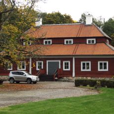
Valsta säteri
2.3 km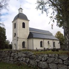
Odensvi Church
1.3 km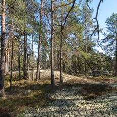
Tängsta
3.4 km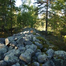
Jätteberget
3 km
2) Hagelsberga
3.3 km
Odensvi 56:1
1.7 km
Köping 189:1
3.2 km
Kolsva 219:2
3.7 km
Köping 29:1
3.2 km
Kolsva 219:1
3.7 km
Odensvi 65:1
469 m
Odensvi 58:1
215 m
Köping 49:1
3.5 km
Odensvi 100:2
2.1 km
Odensvi 41:1
3 km
Jetteringen
1.5 km
Odensvi 50:1
1.1 km
Odensvi 9:1
1.7 km
Odensvi 57:2
25 m
Odensvi 4:2
1.3 km
Odensvi 143:1
2.7 km
Odensvi 187
1.1 km
Odensvi 188
1.1 km
Odensvi 3:1
1.1 km
2) Hagelsberga
3.5 km
Kolsva 138:1
3.7 km
Odensvi 100:1
2.1 km
Kolsva 137:4
3.7 kmReviews
Visited this place? Tap the stars to rate it and share your experience / photos with the community! Try now! You can cancel it anytime.
Discover hidden gems everywhere you go!
From secret cafés to breathtaking viewpoints, skip the crowded tourist spots and find places that match your style. Our app makes it easy with voice search, smart filtering, route optimization, and insider tips from travelers worldwide. Download now for the complete mobile experience.

A unique approach to discovering new places❞
— Le Figaro
All the places worth exploring❞
— France Info
A tailor-made excursion in just a few clicks❞
— 20 Minutes