Romfartuna 136:1, grave field in Västmanland, Sweden
Location: Västerås Municipality
GPS coordinates: 59.75314,16.53942
Latest update: October 25, 2025 15:51
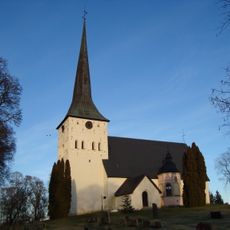
Romfartuna Church
2.7 km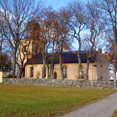
Harakers kyrka
4.9 km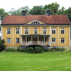
Frövi översteboställe
5.7 km
Hällby
6.1 km
Romfartuna 198:1
3.4 km
Romfartuna 200:4
4.7 km
Älvstenarna
4.4 km
Romfartuna 97:1
3.3 km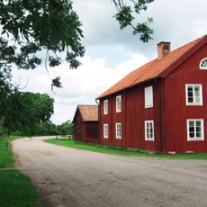
Hallsta by , Romfartuna
2 km
Romfartuna 199:1
3.4 km
Romfartuna 93:1
2.6 km
Romfartuna 187:1
5.2 km
Hällby
6 km
Älvstenarna
4.4 km
Romfartuna 189:2
4.1 km
Romfartuna 194:1
1.7 km
Romfartuna 156:1
5.7 km
Romfartuna 127:1
3.8 km
Kumla 52:1
6 km
Romfartuna 200:1
4.7 km
Romfartuna 88:1
4.5 km
Romfartuna 200:2
4.7 km
Romfartuna 200:5
4.7 km
Skultuna 7:1
5.8 km
Romfartuna 187:2
5.2 km
Romfartuna 200:3
4.7 km
Romfartuna 97:2
3.3 km
Romfartuna 189:1
4.1 kmReviews
Visited this place? Tap the stars to rate it and share your experience / photos with the community! Try now! You can cancel it anytime.
Discover hidden gems everywhere you go!
From secret cafés to breathtaking viewpoints, skip the crowded tourist spots and find places that match your style. Our app makes it easy with voice search, smart filtering, route optimization, and insider tips from travelers worldwide. Download now for the complete mobile experience.

A unique approach to discovering new places❞
— Le Figaro
All the places worth exploring❞
— France Info
A tailor-made excursion in just a few clicks❞
— 20 Minutes