Timmerhöjden, nature reserve in Värmland, Sweden
Location: Storfors Municipality
Inception: November 5, 2013
GPS coordinates: 59.32707,14.31441
Latest update: November 21, 2025 15:40
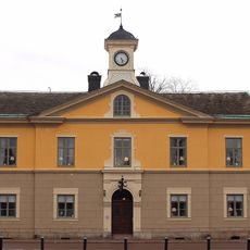
Kristinehamn Municipality
10.7 km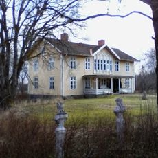
Högåsens herrgård
8.7 km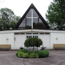
Lunedskyrkan
10.2 km
Lunedet
9.9 km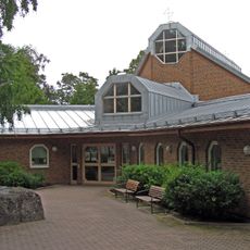
Southern Church
10.3 km
Karlskoga tingslag
10.2 km
Fisksjön
8.6 km
Stora Vilången
5.8 km
Västansjö naturreservat
5.2 km
Gockoöarna
4.4 km
Falbergshöjden
5.9 km
Stora Höjden
3.1 km
Dalstorps skogar
5 km
Råhöjden
4.4 km
Ek, Blinäs
9.9 km
Kristinehamn 29:1
9.7 km
Björneborgs hembygdsförening
10.5 km
Bjurtjärn 20:2
7 km
Bjurtjärn 20:1
7 km
Kristinehamn 29:3
9.7 km
Kristinehamn 29:2
9.7 km
Bjurtjärn 50:2
10.8 km
Hembygdsgården Kristinehamn
10.6 km
Kristinehamn 102:1
9.8 km
Bjurtjärn 50:1
10.8 km
Kristinehamns golfklubb
10 km
Boda borg
9.8 km
Furuhöjden
6.9 kmReviews
Visited this place? Tap the stars to rate it and share your experience / photos with the community! Try now! You can cancel it anytime.
Discover hidden gems everywhere you go!
From secret cafés to breathtaking viewpoints, skip the crowded tourist spots and find places that match your style. Our app makes it easy with voice search, smart filtering, route optimization, and insider tips from travelers worldwide. Download now for the complete mobile experience.

A unique approach to discovering new places❞
— Le Figaro
All the places worth exploring❞
— France Info
A tailor-made excursion in just a few clicks❞
— 20 Minutes