En lönn, Lönnekulla 1:1, naturminne i Ljungby kommun
Location: Ljungby Municipality
Inception: June 13, 1961
GPS coordinates: 56.75304,13.57859
Latest update: November 1, 2025 15:09
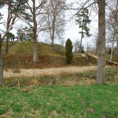
Piksborg
5.9 km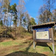
Luberydsmossen
4.3 km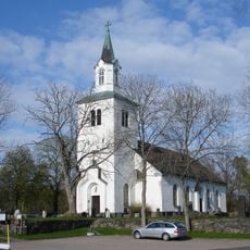
Torpa Church
5 km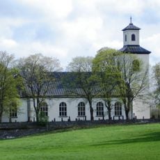
Vrå Church
7.9 km
Jungfrustenen
8.8 km
Torpa 10:1
8.2 km
Annerstad 68:1
6.1 km
Annerstad 71:1
8.5 km
Odensjö 8:2
8 km
Lidhult 35:1
9.5 km
Annerstad 69:1
9.2 km
Torpa 15:1
6.8 km
Odensjö 7:1
7.9 km
Annerstad 129:2
10.4 km
Angelstad 152:1
10.5 km
Torpa 28:1
7.5 km
Torpa 32:1
4.4 km
Angelstad 149:1
10.6 km
Torpa 74:1
1.4 km
Drakaröret
8.2 km
Annerstad 177:1
11.1 km
Odensjö 8:1
8 km
Angelstad 60:1
11 km
Odensjö 18:1
9 km
Odensjö 18:2
9 km
Odensjö 31:1
7.9 km
Odensjö 34:1
10.9 km
Odensjö 133:1
8.5 kmReviews
Visited this place? Tap the stars to rate it and share your experience / photos with the community! Try now! You can cancel it anytime.
Discover hidden gems everywhere you go!
From secret cafés to breathtaking viewpoints, skip the crowded tourist spots and find places that match your style. Our app makes it easy with voice search, smart filtering, route optimization, and insider tips from travelers worldwide. Download now for the complete mobile experience.

A unique approach to discovering new places❞
— Le Figaro
All the places worth exploring❞
— France Info
A tailor-made excursion in just a few clicks❞
— 20 Minutes